Tag Archives: Geocaching

To Space and then Back to Earth

Earlier this week I headed out to the Tulsa suburb of Broken Arrow to find a specialized geocache. It was a space based Adventure Lab Cache. No container to find, just information you need to look up. It was at the Voyage Solar System Walkway. A collection of displays set up along a street showing the relative sizes and distances of the planets to the sun.

Here is the sun, looks like an overgrown basketball.

Just a few feet away is Earth. Barely bigger than a pin prick and its even smaller moon.

And 2000 feet down the street, all by itself, is Pluto. Stripped of planet status recently but still proud.

And I got a virtual postcard proving that I found it. If only virtual anything proves anything. The installation starts at an elementary school which I think is great.

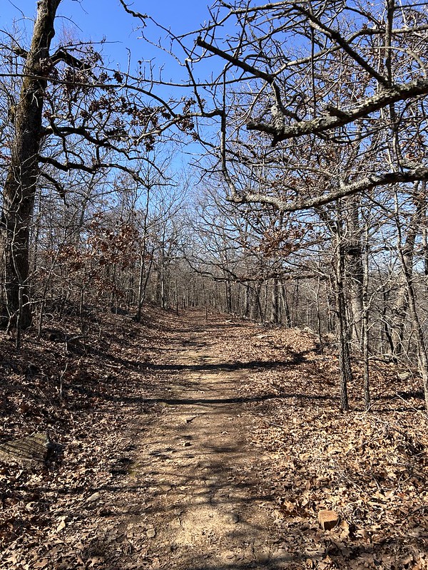
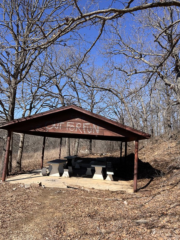
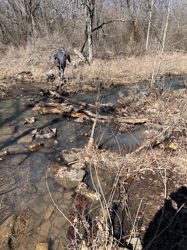
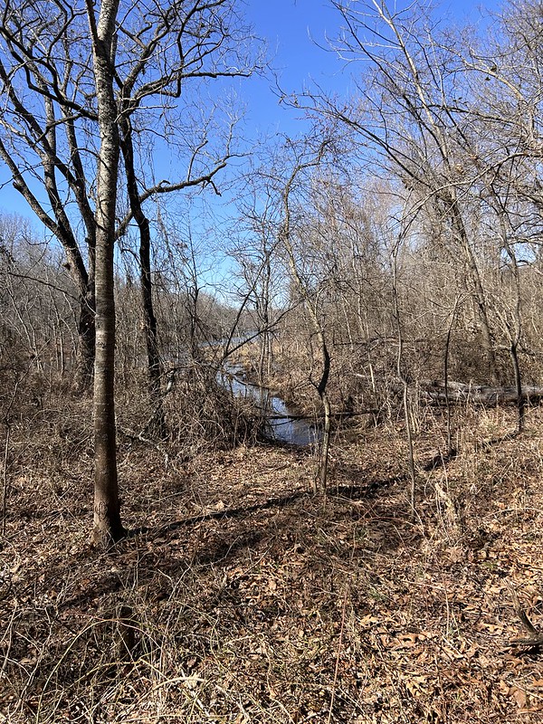
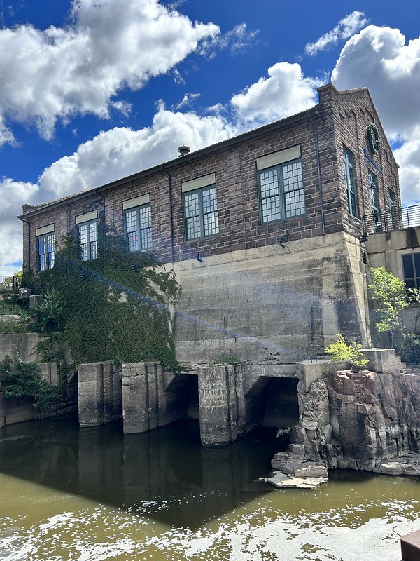
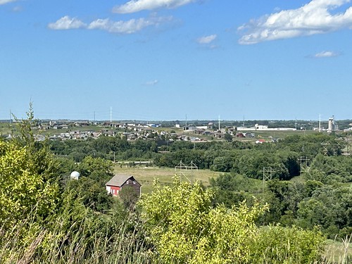
And I went hiking recently on Turkey Mountain. This flyover are still scary to me. They are not for hikers, they are for bicyclists. They really do fly over them. I think all that steel would hurt if you fell off your bike.

My sister and her husband came to town. We had a fun time. One day we went Woolaroc, wildlife preserve and art museum started by Oklahoma oilman Frank Phillips who started Phillips 66 Petroleum way back when. We saw some bison and other critters. My sister is a former Park Ranger at Yellowstone so it is kind of hard to impress her.

The liked the art a lot. Lots of western artists works are hanging at Woolaroc.

I love this stained glass window.

We went to the nearby town of Bartlesville to see Frank Lloyd Wright’s Price Tower. Built for a pipeline construction company, H.C. Price who did a lot of work for Phillips 66.

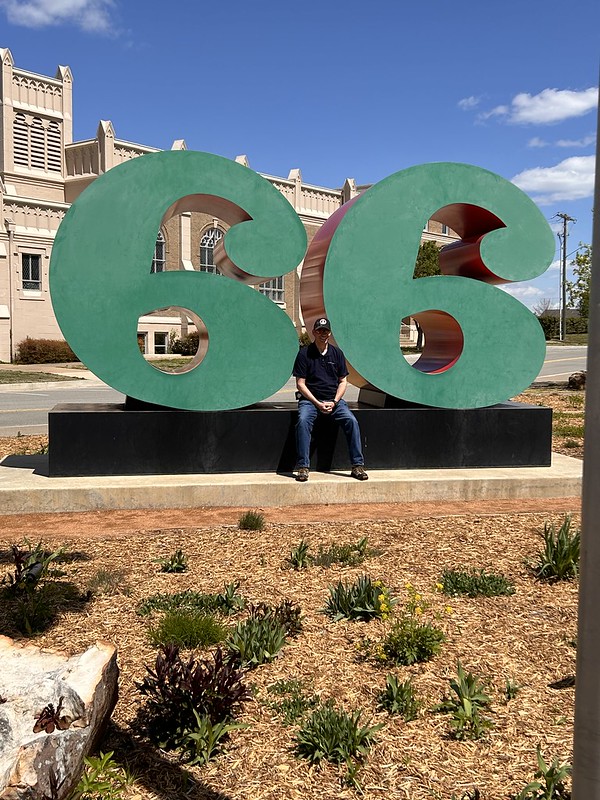
BIL Irv got his photo with a big 66.

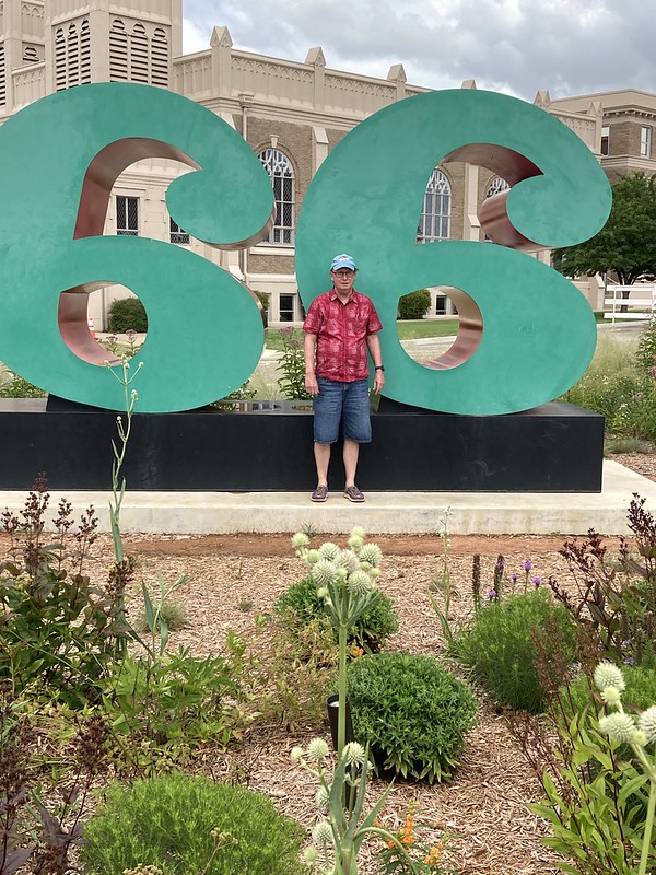
Sister Ellen did as well.

I did several years ago when I turned 66 years old.

_DSC0432

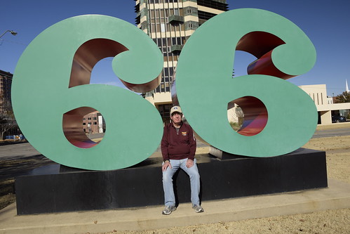
And a few years before that I got my brother Bob’s photo on his 66th birthday.

Speaking of birthdays, I had one early this month. You can tell I am getting kind of old. I just started my 70th year.

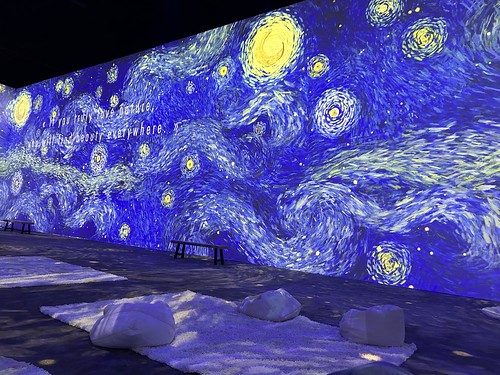
As a treat Heather and Logan took me to see the the Van Gogh Immersion exhibit here in Tulsa. It was very cool.

And I got a cornhole game. Stop by if you are in town we’ll have some beverages and play a few games.

_DSC0109

And I end with yet another Lego animal from the Tulsa Botanic Garden.

I am linking with Skywatch Friday and My Corner of the World. Thank you for stopping by!

Skywatch Friday – The Other Side of Geocaching

I love geocaching. If you don’t know what that is, it’s an online game that you play in the physical world. People hide containers (geocaches) out in the world and then input the gps coordinates online (at geoaching.com) and then others go and look for them and record their success or failure online at the same web site. Most people use an app on their smart phone to play these days. (A better explanation is by geocaching.com at this link.) Over the years I have found almost 2200 caches and hidden about 30 or so. Only three are still active.

Loading the caches

There are ethics to geocaching that you take care of the caches you hide. If they go missing or get damaged or something changes in any way then the expectation is that the owner of the cache needs to replace or repair, or disable it so other people don’t waste their time looking for it. I had two caches that had gone missing so I set about replacing them. The caches are in remote areas and I like to make them easy to find. Also, the expectation is on longer caches is that there be trade items. Mainly they are there for people who bring their kids with them. The idea is that you can take a toy or item from a cache if you have something equal or better to trade.

The first cache I replaced is in a patch of urban woods at the junction of three freeways in Tulsa. It is in a floodplain and hardly anybody would just go there for recreation. So you can get close on a bike trail.

And then you have to duck under one of the freeways and head to the woods.

I put it several feet above the ground. The area floods a lot so there is no use hiding it on the ground plus I like to people to find my caches so I made it kind of obvious.

So I took a different route back to my car. That was interesting. It wasn’t the terrain I though it was going to be. I went close to several homeless encampments and the back property of several businesses and it wasn’t much fun in terms of a hike but it was interesting. The thing is I hate going out and back on the same route. I like loops so I made a loop.

The prettiest part of the hike!

The next cache was on Turkey Mountain. I use the Turkey Mountain parking lots it is 2.5 miles to the cache site. I was in a hurry so I parked at the YMCA adjoining the Turkey Mountain. I’m a member so I just checked in at the office and used the Y’s trails, which interconnect with Turkey Mountain’s trails and saved my a lot of time.

I love trail bridges!!

Here is a view of the Y from across their lake (on Turkey Mountain, ponds are called lakes for some reason. Probably because they named a hill, Turkey Mountain.)

And here is the sign, 2.5 miles to the other parking lot. So I got kind of an express pass.

So is the general location of the cache site. This is the Rock City area of Turkey Mountain. I hid the cache a lot better than I did the other one because there all sorts of bikers and hikers on trails on both sides of the cache. Years ago I hid the cache in amongst those rocks. Bad idea. Nobody could find it and nobody wanted to because they were afraid of snakes. I am afraid of snakes too!! Plus when I did look for it I never could find it. So I would hide another one. That is great except somebody say, “Hey I found two caches close together. Which one is the right one?” That’s embarrassing. So I started hiding it close to the same location but not in the rocks.

This cache is a lot more fun and interesting place to go hiking than the other place.

So I got them both replaced the same day. Lot of fun!! And you can tell that on this second hike, I made a double loop out of it.

I am linking this post with Skywatch Friday and My Corner of the World. Go check both links out.

Skywatch Friday – Geocaching Adventure at Lake Bixhoma

Lake Bixhoma is a water supply lake for the Tulsa suburb of Bixby. It is known for its clean water and protection from wind since it is surrounded on three sides by hills. It has a few hiking trails that are known for being kind of tough plus they have all sorts of venomous snakes there. I’ve been lucky and never seen one except for a water snake last year. The place also has a geocache that has not been found in four years. So I wanted to do two things. Find the cache and hike completely around the lake which I have never done before. I also wanted to lessen the chances of serpent encounter by doing the hike while the snakes were still in brumation (the snake form of hibernation.)

So I started off at the beginning. I couldn’t make heads nor tails of this map at the time. All I wanted to do was avoid the “snake farm” indicated on the upper part of the map. Off I went. You don’t really need a map. Just keep the lake in sight and you’ll be okay. That turned out not to be totally true.

The trail is a mix of old road, nice single track and some pretty technical rocky sections.

Old Picnic Pavillion

They used to have a road that went deeper into the park and had picnic pavilions, restrooms and such. These are now abandoned.

Old Model T Axle

There is evidence of old farms and houses here. I’m told that this is a model T axle. How it got there, I don’t know.

There is a little creek flowing into the lake.

Woman Crossing Creek

Last year I came looking for the cache and turned back at this creek crossing. I had my good camera with me and no walking stick. So I didn’t want to take a tumble into the water. This year I came upon a young woman who had two dogs on leash who was considering the crossing and went ahead and did it even though the dogs were pulling here pretty hard. I said, okay if she can do it I can so I got across with dry feet.

Soon after crossing I started deadheading to the cache. No trail so I was going around thorns and such. Found me this old turtle shell.

And a skull of some unlucky critter.

I got to ground zero which was almost on the lake. It looks like one could take a kayak almost all the way there. In fact almost all the previous finders used a kayak but had to beach it in marshy areas and get all muddy coming in.

I looked for the cache for an hour. I was envisioning something big like an ammo box. I was convinced that the cache had gone missing. “Muggled” they say in the geocaching world. I looked for it for an hour or so and couldn’t find it. I had marked ground zero with my blue water bottle and when I gave up looking for the cache well then I couldn’t find my bottle. So I had to hunt for the water bottle and when I found it, I saw the cache. Which is why I marked the zero point with my bottle. I could have saved an hour, oh well.

The thing is that the cache container’s top had been chewed by some critter and the container was level full of water. So I obviously could not sign the log. I’m still claiming it! I logged the find online and cache owner got back with me and said that they would replace the container.

So then I hiked out. Since I wanted to circumnavigate the lake I had to take the long way out. It was a mile and a half to the cache site and I hike almost two and a half miles to get back out. A good time was had by all is my motto.

I am linking with Skywatch Friday and My Corner of the World.

Skywatch Friday – Life is Better Outside

Life sure is better when you can get outside and do things!

DJI_0914

Launched my drone again from my back yard. I thought the sunset was going to be better than what it was. Better than nothing though.

DJI_0928

I pointed the aircraft west and oriented the camera down a little bit and caught the west side of our neighborhood.

Son, Logan and I went for a hike on Turkey Mountain the other day. It was beautiful. We spent some time on the paved trail next to the Arkansas River.

We had a good time.

I went geocaching the other day. The sky was pretty cool, and I had a successful hunt. It was close to residences and I was feeling watched.

Found some more at a neighborhood park in an older part of town. It was an historic park. For one thing it was close to aircraft manufacturing plants during World War II. The men were at war so the housewives worked. There was an old retired guy who looked after the kids at this park during the workday. I bet that was a zoo.

I got lucky and found a very small geocache, It still counts.

I’m linking with Skywatch Friday. Come check it out.

Where Is It?

I’m a geocacher and have been at it for years. Geocaching is a combination real life/online hobby where one goes and finds caches out in the world hidden by others. Check out my Geocaching 101 post and Geocaching.com for more information.

I got a notification from geocaching.com about a new cache nearby so I went to check it out. It was in a patch of dense woods with no trails or anything. I had anticipated that so I did not wear my “good” clothes to go find it. Too many thorns and sticks that can rip clothes otherwise.

So I got pretty far in and thinking, “this is ridiculous” so I did a 360 video to show how dense the woods are with the multitude of skinny closely packed trees.

I went in a little further and found this old rotten wreath. This could be considered a “geobeacon” or just a decoy. The cache is supposedly located within a few feet of it but it shows to be very tiny. So I couldn’t find it even though I spent about twenty minutes looking for it. And it was getting dark and a little cold as the sun went down so I “plugged and abandoned” as we say in the energy industry and left the premises.

However, as I emerged from the woods I was treated to a great sunset. Sometimes it’s all about the hunt is what I think. Some you find, some you don’t but it’s all fun.

I’m linking with My Corner of the World and Skywatch Friday

Shadows on the Trail

Saturday I took a short walk on a bicycle path to look for a geocache.

Across this funky enclosed bridge across Mooser Creek.

Next to this tree bunch casting some cool afternoon shadows.

The cache is somewhere in the rocks to the left of the tree. Ididn’t find the cache. It’s about the third time I’ve looked. Everybody else is finding it pretty easily. Oh well, I had a nice walk.

I’m linking with Shadow Shot Sunday 2.

Exploring “The Herd” at Lafortune Park

I had some time so I went to check out the “The Herd” at Tulsa’s Lafortune Park. The county parks department commissioned an installation of a herd of bison at Lafortune Park. They had been there forever but wrapped up in plastic so I noticed that the plastic had been taken off so I went to check it out.

Here’s the little red dog or calf.

Here’s the dad. A huge old bull.

And the mom. As with all species the hardest working family member of all. I didn’t get very good photos. Taking photos of bronzes in full sun is some thing I need to work on.

So I sneaked off from the Herd and around the side of the little league ball parks.

And found a geocache. This is unique because it was actually 3D printed from a computer app. That takes geocaching up a notch from the recycled Bismati Rice plastic jars that I like to use.

And then I went by this pond on my wat back to the car. I can’t go by a fountain or pond without taking a photo. This one has a bit of a rainbow on the left side.

I’m linking with My Corner of the World.

Check out Geocaching.com if you are curious about what that is about.

Skywatch Friday – Rio Grande Nature Center State Park

During some free time that I had in September attending my 50th high school reunion in Albuquerque I made my way down to the Rio Grande River bosque to visit the Rio Grande Nature Center State Park. A bosque is the woodlands and land adjacent to riparian streams and rivers. I’ve only heard the term used in New Mexico. Bosque’s are rich in wildlife and plants and after being neglected for years are now being preserved and restored.

I lived in Albuquerque from 1971 until I graduated from college in 1977. The whole time I lived there I never visited the bosque. Part of the reason is geography. I lived in the northeast heights where it seemed most other so called Anglos lived. The north and south valley of the Rio Grande river was considered kind of rough territory to visit. It all seems kind of ridiculous to me now and I feel bad about missing a great opportunity.

I went to do some hiking a little bit of geocaching and mainly just explore and see what was there. There were several serious bird watchers in the park. You know, they have binoculars, notebooks, and cameras with big lens and they have infinite patience staying in one place for a long time before moving on. Hey I admire them but I am not temperamentally suited for such things. I like moving.

I found me a tiny little nanocache. There were others out there but they were off trail quite a ways and there all sorts of signs asking people to stay on the trails. I didn’t want to be “that guy.”

"

One could tell that they had used fire or other vegetation clearing method to open up the woods.

These big metal things are Jack Jetties or Kellen Jetties. The Corps of Engineers placed tens of thousands of these things all up and down the river. They are meant to stabilize the banks and keep the river in its channel. They, along with some dams, worked too well. The river never flooded into its floodplain rejuvenating the soil and drowning out invasive species. The Corps has removed many of the jetties and that has heled the bosque revive.

A big bird watching area is this pond right by the visitor center. They had a large hummingbird feeder that rotated over the pond and I’ve never seen so many hummingbirds. I couldn’t get a good angle on the hummingbirds but you can see the Sandia Mountains off far away. You can see them from all parts of town.

My walk took me right by the Rio Grande River a couple times. Here the river is on the far side of this “beach.”

And here, the river is right by the bank.

So I walked and moseyed about three miles and enjoyed myself very much. The park integrates with an extensive walking/biking trail that goes along the river for miles and connects several attractions. I would sure like to return and explore the area some more.

Skywatch Friday – Falls Park

While in South Dakota in early August for a family reunion another place I sneaked off to was Falls Park near downtown Sioux Falls. I love it there. A huge park with lots to see and great photo opportunities. The Big Sioux River runs through the park and makes a bunch of beautiful cascaded water falls.

They are very beautiful.

For a time in the early part of the 20th century the energy of the falls was harnessed to generate electricity. Those days are gone but the old power house has been repurposed to a cafe. I will say it again, I love it when buildings are repurposed espcially when they are as beautiful as this one.

The falls are loud and are mesmerizing.

I climbed the nearby observation tower and took a photo of the one area of the park. Silly me didn’t take a photo of the observation tower.

And I found several geocaches while I was there. (Geocaching is an online treasure seeking game. Check this link to learn more.) I love geocaching.

There was a sculpture called The Farmer there. Farmers do lots of sitting and thinking of course if they want to be successful and of course they got to get up and do things as well.

Me, I’m not much of a farmer. I’m a retired natural gas guy. I just take lots of photos. I have 89,006 on flickr so far. Five or six of them are pretty decent. Not sure about the rest.

I’m linking with Skywatch Friday and My Corner of the World.

Skywatch Friday – Big Sioux Recreation Area

While in South Dakota in August for a family reunion, I had a little free time so I went to the nearby Big Sioux Recreation Area near Sioux Falls.

It’s a sizeable state park featuring a lot of different terrain. River bottoms, prairie, forest, valleys and hills.

From a low point in the park to the highest point, where I also hiked.

It has a moderate entrance fee and like it seems everything else in the Midwest, is impeccably maintained.

A small geocache hanging in a tree

I went their for the hiking and geocaching.

I had the place to myself during the weekday that I was there.

The Big Sioux River winds through the park. Tell the truth the Big Sioux River seems to everywhere in my family history. Our family church is near the Big Sioux River and many of my relatives were baptized in it. It runs through Dell Rapids where many of my family live and where the reunion is held. It is one of those long winding rivers that seems to be everywhere.

Something about the wind blowing a cottonwood tree

South Dakota is a surprising state. My vision is that it is flat but for a flat place it has lots of hills and valleys and even mountains and forests. Think Mount Rushmore and the Black Hills.

It has lots of big majestic trees.

And high hills with great views and skiesl

I didn’t spend much time there. Went on a little hike, found a few geocaches and took some photos.

A video of a geocache find I made.

Big Sioux Recreation Area is relatively unknown gem of a place. I’ll be back.

I’m linking with Skywatch Friday