I wear a Garmin GPS enabled watch while running. It is kind of magical. I turn it on when I start running and turn it off when I’m done. While I’m running it is feeding my phone via a blue tooth link all sorts of information like where I am such. At the end of the run I can get on the web and see all the statistics and a map on a service linked to Garmin called Strava. I always thought it was kind of cool. Like below is a map of my run this morning where I trotted up and down the Arkansas River for four or so miles.
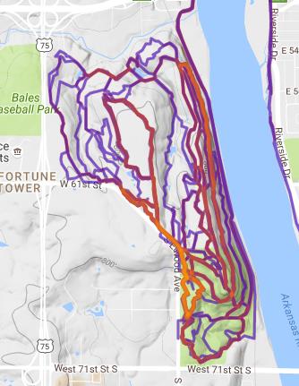
You know what is cooler. Seeing a view of a particular area with a bunch of runs superimposed to see if a pattern emerges. That is called a heat map. Generally the various services want extra money for that but I found a web site that does it for free. I am really into free. Jonathan O’Keefe has a free service for generating heat maps. The following is what it generated for my runs on Turkey Mountain. So you can tell I pretty much have Turkey Mountain covered.
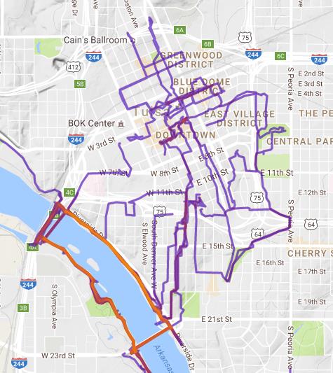
And here is my heat map for downtown Tulsa. I have it pretty much covered also.
Anyways, I love little gizmos like this.


If I were a runner, I would probably have one of these. I am a bit of a gadget nerd and free is the best when it comes to software.