Tag Archives: flooding

The Flooding Winds Down in Tulsa

_DSC0944
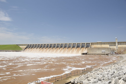
Keystone dam on Friday, flowing 195,000 cu ft per sec through the gates.

The waters of the Arkansas River in the Tulsa area are rapidly falling. The waters flowing into Keystone Dam above the city declined rapidly which gave room for the Army Corps of Engineers to start closing the big Tainter gates and reduce the water drastically.

_DSC0945
Close up of the Tainter Gates controlling the flow out of the dam.

The peak flow was 275,000 cubic feet per second, now is down to 120,000 which is high but low enough that the river is back in its banks.

Downstream of Tulsa things are still bad, Muskogee still has a lot of flooding, and it is even worse in Arkansas where a major levee has been breached.
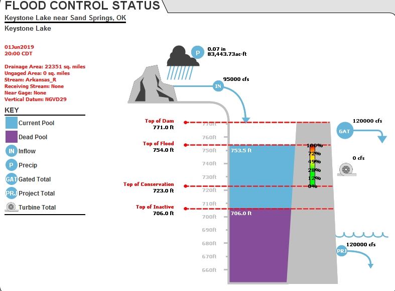
The images above and below are screen shots from a Corps web site. People had them open on their screens all day, refreshing and posting what the latest inflow and outflow numbers were.
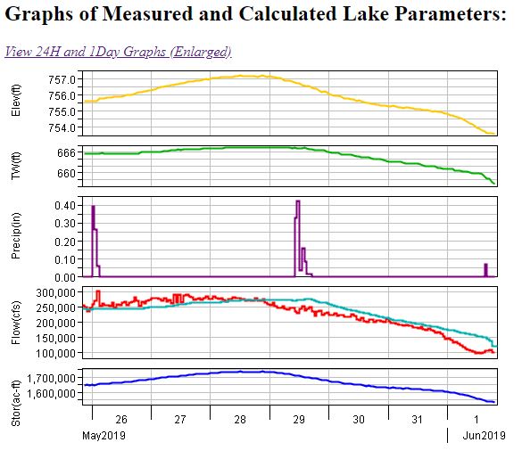
I think that this has been a wake up call for the whole community. Personally, I thought with a big dam upstream that a major flood was pretty much impossible. Well, it is possible and we were lucky that the levees held and that the rains held off. With the climate change we are experiencing I am wondering if we are going to see these occurrences more often.

The local paper, the Tulsa World, produced the video above and the links I reference below.

An oil and gas producer who had tanks flooded mishandled the situation and ended up in hot water. Read about it here.

The waters are lower and residents are starting to return to their homes.

The Tulsa World also has a listing of handy phone numbers and internet links that might be helpful.

Our World – Tulsa Oklahoma Flooding – 2019

_DSC0930

We went to Colorado last week and while we were gone, it flooded in our home town of Tulsa, Oklahoma. Our home is high and dry but not everybody is so lucky.

20190524-140633-8

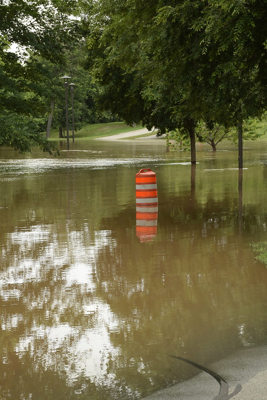
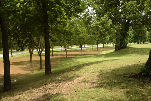
I take pains not to be a problem and so I didn’t visit where people’s houses were flooded. I took a couple trips to the RiverParks area of Tulsa, a strip of public park along both sides of the Arkansas River as it flows through town.

_DSC0931

In 27 years of living here I have only seen the trail covered for a 50ft section or so once or twice. Now, whole section of the trail are under water and the water is a foot or two higher than what is shown in these photos.

_DSC0926
_DSC0925
DSCN9473

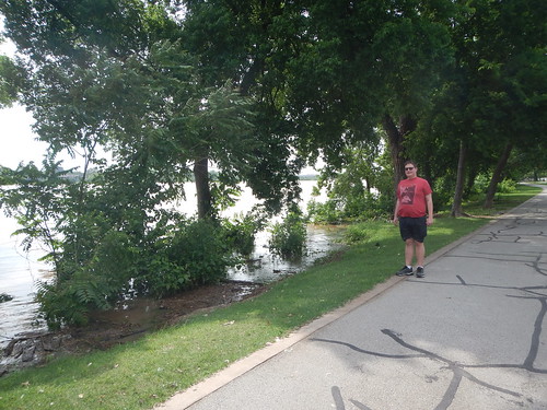
These are newer photos from Sunday when son and I visited the northern section of the RiverParks. The water is even deeper now and is expected to get worse over the next week or so as it continues to rain in the Arkansas River watershed.

DSCN9472

Check out the Tulsa World site for more photographs of the flooding.

The Arkansas River is flowing swiftly. It now reminds of me the Snake River in Idaho which also moves swiftly.

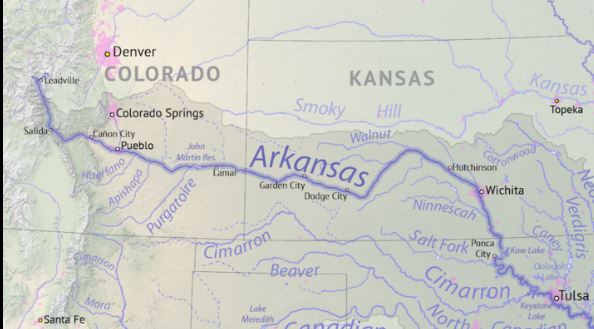
So what is happening? The Arkansas River gathers water from a huge area. The basin in drains ranges from Leadville and Colorado Springs, Colorado and almost to Santa Fe, New Mexico to Tulsa. It all funnels through Keystone dame above Tulsa a few miles and it is way over flood stage behind the dam.

And to add insult to injury, we have had tornadoes. We spent Saturday night in our desigated safe room, our downstairs guest bathroom, with our cats and dogs in crates and we three humans holding flashlights and our cell phones waiting for the all clear. Our son said at one point that it was all a roll of the dice! Yep that is right son.

We are lucky though. The tornado passed about a mile south of us and our house is high and dry. So we are blessed but are remembering those who are not so fortunate as us.

Here is a link to a live infographic by US Army Corps of Engineers for the Keystone Dam showing lake levels, inflows, outflows, and other data.

I am linking with OurWorld Tuesday