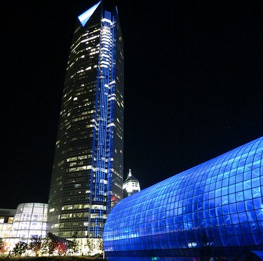
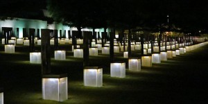
Walking around at lunch with my Ipod. Lots of windows in this old building. Each window tells its own story.
Category Archives: Oklahoma
Our World – Turkey Mountain Urban Wilderness Area Cleanup Day
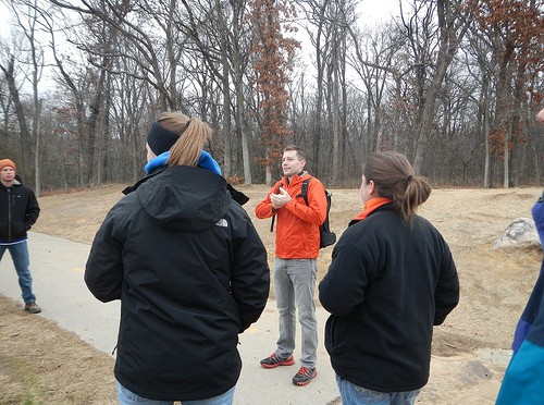
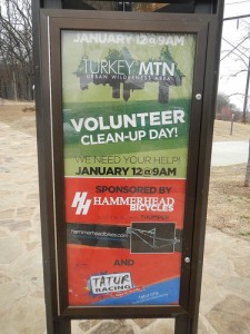
Saturday morning almost a hundred people showed up at Turkey Mountain for a cleanup day.
It was organized by the Tulsa River Parks Authority and sponsored by Hammerhead Bicycles and Tatur Racing. Anytime you can get the mountain bikers and the trail runners working together it has to be important.
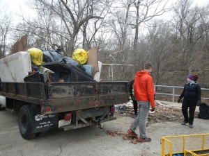
Lots of trash was picked up along with old worn out grills, a camo recliner and couch, and several mattresses. Four meth labs were found.
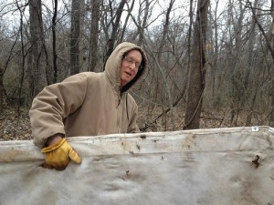
An extremely rare photo of Yogi actually doing anything. I stole this photo from Trail Zombie’s facebook page. If he sues me, I’m going to depend on you to contribute to my legal defense fund. Sweetie is going to think this was photoshopped. Trail Zombie reported on the cleanup on his blog.
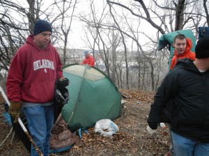
Several of us went to an active campsite to dismantle it and haul it off. In addition to the tent, tarp, sleeping bags, and other stuff, we filled up two or three contractor size garbage bags with the garbage strewn in all directions around the site. By the time we left there was no trace that anybody had ever been there. Before you start crying tears over the lost home of whoever I’ll just say the contents of the tent might have indicated that he was up to nothing good.
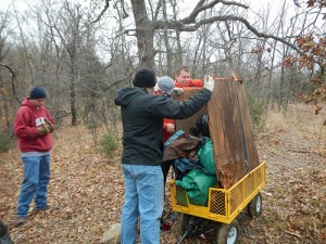
We loaded it all up on a wagon we had and hauled it off.
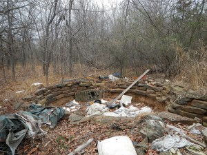
There is still a lot of work left for the next clean up day. This is a non active homeless camp with garbage spread in all directions.
Our World – Oklahoma’s Natural Falls State Park
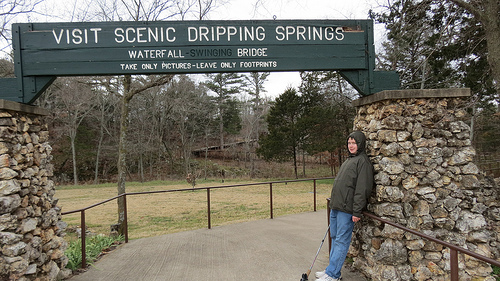
Saturday, SuperPizzaBoy and I took a road trip about 75 miles east of Tulsa into the Ozarks to Natural Falls State Park. It used to be a private park called Dripping Springs and when Oklahoma took it over they renamed it because we already had a Dripping Springs Park.
We pretty much had the park to ourselves because of the cold and windy weather. One of the things we did was log an Earth Cache named “Dripping Springs.” Earth Caches are part of Geocaching except that you don’t look for a container. They are more educational in nature and lots of fun.
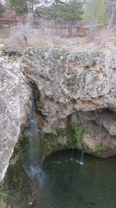
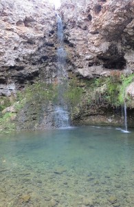
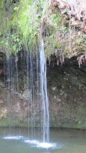
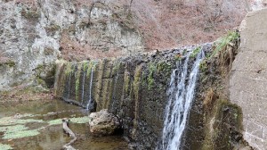
The star of the park is of course the waterfall. You can’t tell it from the photographs but the water falls about 77 feet.
Down in the canyon where the water lands it was much warmer. No wind of course but I would guess the temperature seemed at least five degrees higher than up top.
There is something about falling water that is very peaceful. The park was used in the filming of the 1974 version of “Where the Red Fern Grows” based on the book by Wilson Rawls.
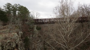
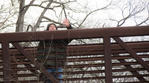
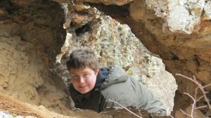
There is a bridge across the chasm. Hey, who’s that kid up there?
SuperPizzaBoy, that’s who. I wondered where he got off to.
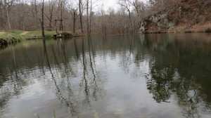
There is more to the park than the falls. The creek flows from the falls to a small lake.
You can tell this dam has been here for a while. Full disclosure, to keep the falls falling, they pump water from this lake back up to the falls. We have been having a drought here and the falls would probably be a trickle if anything.
Son and I did a big part of all the trails until we called it quits.
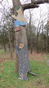
I love the goofiness found in some of the State Parks.
We only went about two and a half miles but it was fun.
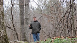
The trails vary from easy level hikes through the woods to “where did the trail go?”
You can follow our very slow route on Garmin Connect by clicking on the green tag above. It will take you to another screen. Click on the button that looks like your “play” button on your dvd player.
Anyway a great time was had by all.
Weekend Reflections – Blue Whale
Our World – The Blue Whale of Route 66
The New Year is almost here. Have a happy and safe New Year’s Eve!
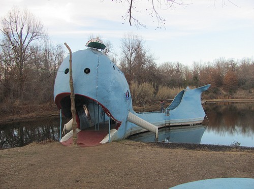
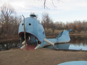
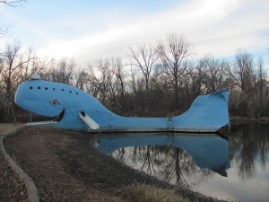
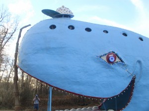
Just before Christmas SuperPizzaBoy took a one day road trip. As previously reported we went to see the World’s Tallest Totem Pole. On the way back we stopped at the Blue Whale on Route 66 in the city of Catoosa.
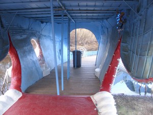
The Blue Whale was built by Hugh S. Davis, a former Tulsa Zoo employee, starting in late 1960’s and finished in 1972 as a gift to his wife.
A welder friend of his welded the pipe framework and Mr. Davis applied the concrete one five gallon bucket at a time.
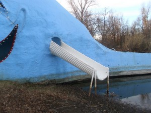
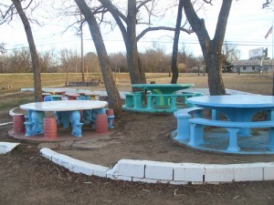
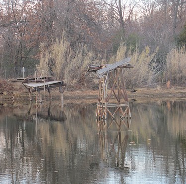
He built slides off the whale into the pond and a diving platform off the tail. He opened up the whale and pond up to the public for swimming, picnicking, and fishing. Mr. Davis is gone now and the property is owned by his children.
(SuperPizzaBoy Photo) – Notice the potbellied, bald headed, old man that looks like he is getting swallowed by the whale? That is SPB’s father.
It is now maintained by the Catoosa Arts and Tourism Society. It is free of charge and they allow catch and release fishing but they don’t really want you swimming there.
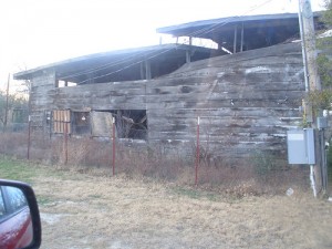
Mr. Davis also built other attractions on the property that are in disrepair and off limits but the remains can be seen from the parking lot.
This is the Ark that he built, he also had an alligator ranch and a praire dog village. Stuff like this intrigues me.
So if you are ever in the Tulsa area check out the Blue Whale in nearby Catoosa, right on Route 66.
Swimming Hole
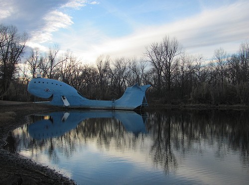
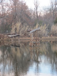
Weekend Reflections – An Old Swimming Hole off Route 66
All that is remaining from an old swimming hole in Catoosa, Oklahoma right off Route 66.
A shot from the short road trip Son and I took on Sunday.
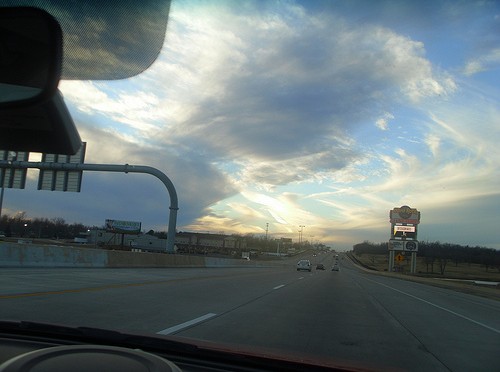
SuperPizzaBoy Road Trip Skywatch
Son, SuperPizzaBoy took this image of the sky while we were coming home from our little roadtrip Sunday.
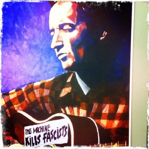
ABC Wednesday – “W” is for …
This week’s letter is “W.” “W” matches two of Oklahoma’s home state heroes.
Who doesn’t love Will Rogers. Could he poke holes in windbags or what? In a nice way of course.
And speaking of poking holes in windbags, how about Woody Guthrie? People still get riled up about him in Oklahoma. I wonder what he would think of the tea party?
Our World – Road Trip to see Ed Galloway’s Totem Pole Park
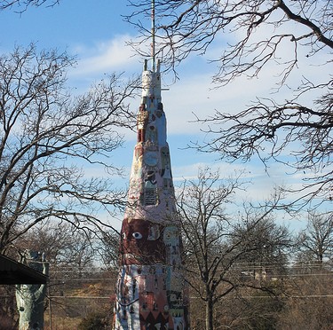
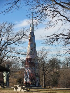
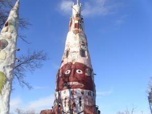
Sunday, SuperPizzaBoy and I loaded up and headed up Route 66 northeast from Tulsa to the little town of Foyil, Oklahoma to check out the world’s largest concrete totem pole.
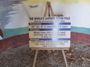
The totem pole is 90 feet tall and is made of concrete over a metal and sandstone base. He started working on it in 1937 and finished in 1948.
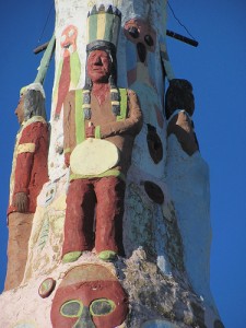
The exterior has many bas relief native American inspired designs.
Apparently when asked why he built it he just said that he needed something to do when he retired.
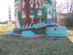
The base of the tower is a turtle. He fashioned it from a sandstone outcropping that was already in place.
There is a small room inside that contains more artwork and an informative sign. If you start googling you will see find that there are lots of totem poles taller than ninety feet. So maybe this is the tallest concrete totem pole.
SPB brought his camera. Of course a self portrait was in order.
Hmm, this is also a pic of his, That is the scariest face on the Totem.
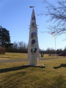
SPB also captured images of some Galloway’s other pieces. I love the arrowhead below.
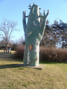
I’m guessing this is a tree trunk.
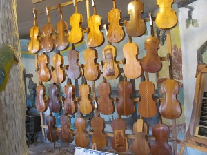
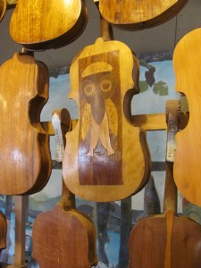
The park has a gift store inside the “Fiddle House” that includes a variety of fiddles carved by Mr. Galloway.
This was my favorite
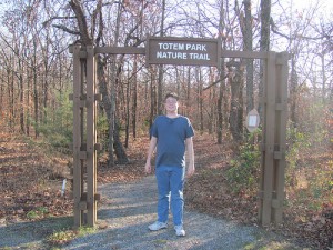
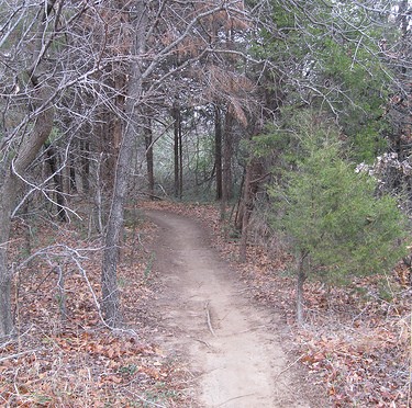
The park has a short nature trail which of course we tried.
Galloway died in 1961 and the park fell into disrepair until rescued in the late 1980’s by the Rogers County Historical Society who runs the facility today.
We’ll post the second half of our road trip next week, unless of course we decide to do something else.
National Park Service Article on the Totem Park
Roadside America Link on the Totem Park
I Gotta Go Find Something on Turkey Mountain
Saturday, I had several free hours. Anytime I have a few free hours I’m going to running and geocaching and photographing. Most likely I”m going to do that on Turkey Mountain. Tulsa’s urban wilderness area. Its close in and convenient.
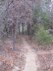
So I hit the trail with a bunch of equipment. My running GPS enabled watch, my Geocaching GPSr, a camera, and my smartphone. And a pen. Can’t go geocaching without a pen, and a knife. Right?
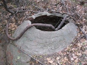
An old cistern. I don’t know but I get the impression that Turkey Mountain was a rough and ready oilfield and farming area. There is some oilfield debris still left but very little left of farmsteads and such.
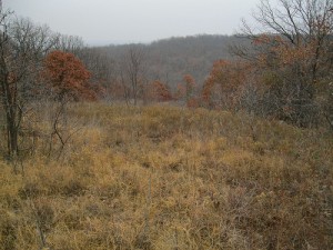
Parts of Turkey Mountain seem very remote. I’ve been all over the mountain and some areas, you just never see anybody.
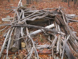
Lots of mysteries, like what is this? An old outhouse? Who knows.
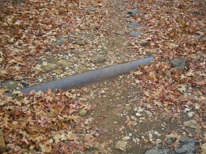
There are a few old pipelines left. I don’t know if they are live or not. I can tell you, and maybe you should listen. You can’t proceed just on assumptions. Unless you want to bet your life on it.
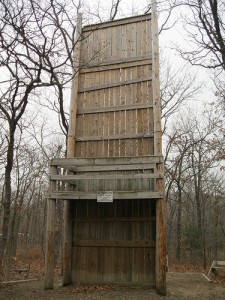
At the far end of Turkey Mountain from the parking lot you run into the Westside YMCA. Nice place for urban kids to get some nature in them. The Y has a “Ropes Course.” I helped build part of it as part of a United Way Day of Caring event about 20 years ago. Ropes Courses were all the rage back then but you don’t hear that much about them anymore. The theory is that you take a group of coworkers out in the woods and have them work on things together and that leads to better teamwork.
Sorry to water on the parade but let me tell you how guys work. (Women, you have to speak for yourselves.) The way guys work is that you can take a group of guys who hate each other and put them on a team to do something and it’ll be great. They will work together to complete the task. When they are done, they still hate each other. I did ropes years ago, climbed the rope ladder, did the zip line, walked the cable, jumped off the poles, did the trust fall, the whole shebang, helped my team mates over the wall. I’m done. No more. How about some golf instead? Does just as much good!
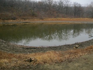
I finally reached my objective, Pepsi Lake. Don’t snicker at it, we have had a drought and the water levels are way low. I came out here to look for a geocache. named “What are these doing here...” A cache that I’ve looked before and couldn’t find.
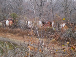
The “these” are Pepsi delivery truck bodies arrayed on the dam. Why they are there. I don’t know. There is a Pepsi warehouse closeby. Maybe this is where they send their trucks to die.
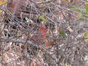
Oh, by the way, I did find a cardinal playing hard to get in the shrubs near the trucks.
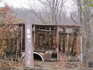
I also found the cache. Not very many people have found the cache. I’d love to show it to you but the owner of the cache has threatened to delete the logs of anybody who gives a clue. DELETE the LOG, to a geocacher that is worse than any fiscal cliff, or the Affordable Health Care Act, or even the Designated Hitter Rule. So sorry no clues from me.
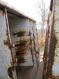
I will tell you that I climbed in, under, and on top of these before I found it.
I wore my GPS enabled running watch. It ran out of juice while I was searching for the cache. You can see me route to the cache from the parking lot, just hit the white triangle on the green circle. It’ll take you to the web site. Hit the button that looks like your DVD play button and you will see just how slow a runner I am.