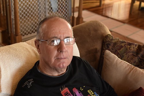
I got sidelined for a few days with a sore knee. I finally went to the bone doctor and he gave me a range of treatment options from continue using OTC Ibuprofen to getting a steroid injected in the knee to a “surgical solution.” I opted the steroid in the knee. And it helped but I’m not 100% yet. We’ll just have to see how it goes.
I’ve been out and about. My wife and I had our 35th anniversary the other day and so we went to the zoo and 16,000 steps later my knee was calling my name!!! It felt great at first.
From a week or so ago. Part of a series of photographs showing that it was raining all around us except where we live.
And a cheerful morning sunrise
And an optimistic Labor Day. I fly my flag right side up!!
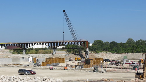
And a long last, the new Dam and Bridge across the Arkansas is done. They had a whole multi day party to celebrate over the Labor Day weekend called the “Big Dam Party.” I missed it all. I got out there Tuesday morning and checked it out myself. I had my own dam party.
On our recent New Mexico vacation we spend just one full day in Santa Fe before returning home. But we saw and did a lot in that one afternoon, and one full day afterward.
The monsoon was going on so every afternoon it would cloud up and rain. Usually just a little bit but on our final evening we had to call the hotel for help so they sent their shuttle. Saved us from getting soaking wet.
Santa Fe is a mixture of the old and the new. I remember as a little kid living in Coyote and mom would take us shopping in Santa Fe. Those art galleries and fancy shops that are there now? They used to be Woolworths, JC Penney’s, Western Auto. Lots of tourists back then as well but Santa Fe was a town where regular people lived.
It’s got some great museums. This is the courtyard at the New Mexico Museum of Art.
And food. I forget just how much I like New Mexican food until I go back. How about some chicken enchiladas with green chili sauce for lunch?
And history? Ancient history and modern history. I saw this little plaque at the back of a store. 109 East Palace was the address where everybody who worked at Los Alamos during the World War I first reported to duty. I read a book about the goings on, 109 East Palace: Robert Oppenheimer and the Secret City of Los Alamos by Jennet Conant I love reading about the makings of the Atomic Bomb way back when. It was a huge nationwide effort and involved lots of people. My mother worked as a secretary at the Hanford Nuclear Works in Washington which used a reactor to produce plutonium and chemical processing to enrich it. Plutonium from Hanford was used in the first atomic explosion in New Mexico at the Trinity site.
The Saint Francis of Asis Catholic Church is located in the northern New Mexico town of Ranchos de Taos. It was constructed between 1772 and 1816 and is still an active church. It is built of adobe and the church members spend two weeks in June ever year remudding the exterior with a mixture of mud and straw. If you look closely you can see the straw in the exterior walls. It is considered to be Spanish Colonial architecture.
The church has been a favorite subject for years by artists and photographers including Georgia O’Keefe and Ansel Adams. (Check the links for images of the art work.) The artists have focused almost exclusively on the back of the church which has three massive beehive shaped buttresses. I guess that I am not artist because I find the front of the church to be much more interesting.
The interior is gorgeous. The altar looks beautiful. I brightened the image above so you could see but did not advance beyond the closed entrance door. It was almost pitch dark and did not want to disturb anyone who might be in there praying.
I’ve been seeing this church almost my whole life. Whenever we went through the area when I was a kid we would stop and look. I think it has an almost magical presence. It had been almost 30 years since I last saw it though before our recent trip and I still love it.
Continuing our saga of our New Mexico vacation. We got to Red River in the beautiful Sangre de Cristo Mountains and didn’t waste any time hiking the day after we got there. I hadn’t been in the area in 50 years and back then I wasn’t a hiker. So we consulted the redriver.org website and the alltrails app and kind of converged on the nearby Columbine Creek Trail as a good moderate trail. Plus it was only about five miles from town so off we went.
We didn’t see much in the way of critters but there were wildflowers. I had my Merlin App going and it captured the Northern Flicker in a particular section of the trail and not much anywhere else. I caught glimpses of it but not enough to feel comfortable adding it to my “life list.” Those dang birds need to sit still for at least 30 seconds for me to get my camera out, adjust the settings, focus and all that to get a good photo. Those little birds are so rude they way they hop skip and jump all over the place. Just call me Karen and point me to the manager.
Gotta tell you walking through an aspen forest got my feels going. Did that all the time when I was just a kid. Haven’t hardly done it since. I love it. Brings back lots of memories.
And a cold, clear mountain stream. We have lots of water in eastern Oklahoma (and I love it here) but very few clear running streams.
Just one more time on the aspens. Promise!!
The trail crossed Columbine Creek several times. The Forest Service put in these deluxe bridges. I cannot imagine the amount of work to put the bridges in and then keep them maintained.
And I loved the rock cliffs.
I googled the heck of “Quetta” so I don’t know who this person is but they obviously loved the trails.
Here’s two of my hiking team.
We didn’t make it to the promised waterfall at the end of the trail. We were getting low on water and we are flatlanders playing around at over 10,000 feet so we turned around. There will be plenty of waterfalls in our future. So headed back to the trailhead and got there safe and sound. So we got four miles in for the day.
And now a blast from the past.
Our hike reminded me that when I was in high school our family hiked somewhere along the highway in one of the Forest Service campgrounds. I remember dad pointing up to a mountain and saying that there was lots of molybdenum in the rock and that it had been mined there for decades. The mineral is used to harden steel in everything from bulldozer blades to mountain bikes and is very valuable. So I looked it up and molybdenum had indeed been mined there for a long time and the biggest mine, owned by Chevron Mining, was an open pit mine right across the road from the campground where our trailhead was. I got on google maps and the mine looks a lot worse than it looks from the road. It is a huge open pit mine.
Chevron shut the mine down in 2014 and settled with the State and the Feds for over $140 million in cleanup costs from the damage of runoff from the mine into the Red River. Chevron is still cleaning it up and is still helping the downstream village of Questa deal with transitioning their economy from mining to something else. Mining is necessary for our modern life but cleaning it up is an expensive, lengthy process. I think they are pretty close to completing the project.
Hey I apologize for digressing but I found the mine fascinating and was amazed at how much damage it caused to the surrounding area.
One day last week I started out from Turkey Mountain’s upper parking lot and had to check this device. I’d love to have one in case anybody is wondering what to get me for back to school! I’m not going to school but you can buy it for me anyways.
And then I went tot the north end of the parking lot and took this shot of downtown Tulsa. Turkey Mountain is a true urban wilderness. It’s only about six miles to downtown.
And then I took the new Three Pillars Trail over to the Three Ponds. I keep hearing they are the three sisters or the three pearls. So I don’t know about those names but they are definitely ponds so I am using that for now.
They are going to make some great season photographs.
Nice reflections everywhere you look.
I left the ponds and continued westward when I found this fella. I posted this same photo on my Saturday’s Critters post last Saturday. It’ a rat snake, and they are not venomous.
And then went and checked on my most previous employer’s pipeline they are building through the park.
They are doing a good job. The right of way is in good shape and the welders, pipefitters, equipment operators, x-ray hands, and inspectors are not out and about wandering all over the place, poaching deer and fishing the ponds. At least not during working hours.
I’m told that they are going to be done pretty soon and they are going to mulch the right of way and plant a wildflower mix. That sounds good to me.
I went a little bit further and find a couch to relax on. It looked a little firm to me so I just kept moving.
Went down a side trail and had to double back. The pipeline folks were excavating and didn’t want any tourists or know it all retired pipeline engineers.
I passed this little mess. Years ago, Turkey Mountain was an oilfield and the workers had trash pits they covered up. Well they are getting exposed now and the old trash is coming to the surface.
And then I went back to my car. I was hot and tired. It is warm here in Tulsa.
The other day, the moon here was 99% full and we had some scattered clouds so I took some photos. This one looks like the moon has a face, featuring a split lips. Reminds me of a cat actually so I guess this isn’t a man on the moon it’s a cat or man in the moon kind of thing.
We had some color in the sky the other day so I launched the old drone. This is looking roughly south of northwest from our house. About 40 meters up.
And this is a similar view looking straight west at the same elevation.
And this is roughly southwest.
And looking straight east. One can see the faintest tints of pink in the clouds. I love reverse sunsets.
And that is it this week. I am linking with Skywatch Friday. Come check them out.
The other day I grabbed up my hiking gear and headed out to Tulsa’s Turkey Mountain Urban Wilderness. I took my “grabbers” and a small grocery bag to gather trash. People are pretty good about picking up after themselves so I used to take a small garbage bag but I usually only find an item or two during my hikes.
I took a little side trail pretty soon after the trailhead to find a geocache.
And yep I found it. Another use of grabbers is to grab into places you can’t see so that mr snake doesn’t clamp down on my hand. That would ruin my whole day.
I didn’t see too many critters. A few squirrels maybe, no big critters. I took along my Merlin Bird ID app on the phone. It’s amazing. Turn it on audio mode and it identified: Red-eyed vireo Tufted Titmouse Carolina Wren Northern Cardinal I didn’t see a one of them!! I glimpsed small birds flitting around in the thick woods but I couldn’t vouch for any of them. One I did get a good look at looked like a small woodpecker with a redhead but it wasn’t making any sounds. I don’t know what it is though. It’s kind of frustrating but kind of fun as well. I think being able to spot and ID them will come with practice and patience.
I came upon a fallen tree on one of the small legacy trails. I took a photo of it with my Solocator app which puts the coordinates on the photos and posted it on Turkey Mountain’s facebook page and they had it cleared before I ended my hike. You gotta have the apps folks.
I got to Pepsi Lake and looked around.
I found a mess that somebody left, including a styrofoam cup and some fishing spinner bait packaging. Why can people not haul out what they haul in?
And a Pepsi can, at Pepsi Lake! All the trash fit into my shopping bag that I brought.
I kept heading north and heard some construction type noise. Excited that more trails might be under construction made me hurry to find the source.
It was pipeline construction going on. Ironically my former employer is having to relocate a line because of some highway construction and they cut a deal with my employer before that to lay in their right of way.
That’s not the way the energy industry typically was back in the old days. You had to have sharp elbows to survive. We didn’t spend too much time holding hands and singing Kumbaya with competitors let alone helping each other out. So maybe it is a kinder and gentler industry now?
So I followed the construction from a distance just to make sure that they are doing it right. I guess they are and I was getting tired so I headed back to the parking lot.
The other day I went on a bike ride on the RiverParks Trails around the Arkansas River in Tulsa.
I always check my weather app to check the prevailing winds. I like to go against the wind on the outbound leg and with the wind on the inbound leg. So today I started on the south end because the wind was from the northwest. I crossed the 71st bridge. It is always nice when the river has water in it.
Got across the bridge and hung a right onto Elwood to pass through Turkey Mountain.
I love riding the west side trails. I haven’t done it too much since the last several years since some of the trails have been closed for construction of the new Zink Lake Dam.
This fully enclosed bridge over Mooser Creek always tickles me. Why is it enclosed?
I got up to the soccer fields and checked out the detour map. The trails are opening back up on Labor Day Weekend. They are having a Big Dam Party to celebrate the completion of the Zink Lake Dam, construction of the new Pedestrian Bridge, and reopening of the closed west side trails. I’ll be celebrating, at home, and I’ll check out everything when the hubbub dies down. That’s how I roll.
Oh, yeah, I found a geocache near the sign.
And a guy passed by on this recumbent three wheeler complete with flags. Thankfully, they were right side up.
I deadheaded up the trail past the old PSO Power Plant. I love old infrastructure, even when it doesn’t run.
And go to the sign, “No Public Access” one sign says, the other says “No Bicycles or Scooter.” If you look to the right of the gate, it is propped open and there is a well worn trail there.
I had been wondering how these folks were getting to the river to go fishing. Now I know!! I don’t have a problem with it. These people have had to walk about a mile to get there and by gum. They deserve to fish!! (I am not being sarcastic. I love it when rules are bent to the will of the people, unless it is an insurrection of course.)
So I turned my bike around and headed back down to the soccer field and headed out on the trail detour.
This part used to be scary on southwest boulevard. The road was all torn up and with gravel and such. Plus they had four lanes which made for a tight bike lane especially with tanker trucks going to and from the refinery, dump trucks and other big vehicles that are part of Tulsa’s industrial west side. Then they had a long construction project to redo the road. That was a disaster. No bike lanes, no nothing. The one time I rode it I had to ride on the west side business parking lots cuz I didn’t dare get on the road. I drove the section last week and noticed construction was over and that is why I was riding the bike lane today. I felt pretty comfortable in the bike lane.
So I got up to Route 66 and went across the bridge.
And headed back down south to the car. Didn’t take too many photos. I took some photos of some critters and you can check those out on my post Saturday.
Anyway, almost 18 miles, going slow, stopping and taking photos plus found one geocache. My longest ride in a while.
I’ve heard about drone shows that use drones instead of fireworks and I have been fascinated by the idea for some time. On July 3rd we headed to the Tulsa suburb of Sapulpa to check out their drone show. They advertise it as an alternative to fireworks and suitable for small children, dogs, and people who don’t like loud noises.
Hear is a local news clip about the show
And the following are some video images of the show I captured with my phone. Sorry about the dim images. At the end of this post I have a youtube video of last year’s show as shot from a drone and has lots better video than what I captured.
Of course you have to have a flag. My videos don’t give the right impression of how big these displays are. They used 400 drones and they were pretty high up. I’ve looked at other drone shows on youtube, some of them use thousands. Most of the videos are speeded up way too much.
USA! USA!!
I’m thinking this is in honor of Chief Sapulpa, who is buried in Sapulpa.
A giant pinwheel
Ok you have to squint really hard to see this. The drones are simulating a fireworks show.
And so this is last year’s show as shot from a drone.
However you enjoy the Fourth, be safe and be nice.