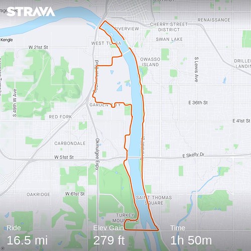
On Sunday, July 20 a couple weeks ago I took off on a bike ride on the Tulsa RiverParks. It was hot and I didn’t start until midmorning for various reasons so things got a little warm.
Sunday is a big day for Tulsans to get outside and ride their bikes, run, walk, whatever on the RiverParks. The traffic is mainly on the east bank so I started out on the east bank and went up and down the west bank just to get away from people.
Still, it was pretty busy but not overly so.
I was passed by almost everybody except…
…for people standing.
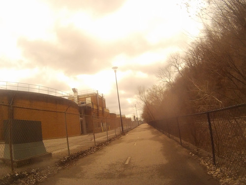
I always love going by PSO’s old Tulsa Power Station electric generating station. That sign looks really nice at night.
I got to my predetermined turnaround point and rested a bit and drank some water and then reversed course. I always check the weather apps to see which way the wind is blowing. I don’t mind riding into the wind on the outbound leg, that way I have the wind at my back going back to my car.
I was one hot, thirsty, old bike rider at the end! 14 miles all told.
A squirrel getting a drink and scrutinizing the trailcam
Catching Kodi, the Pomeranian, in the back yard
I went on a hike at Ray Harral Nature Center. Most of the critters were elusive. This fat little guy watched me while I walked by as he ate his lunch.
I could hear birds but didn’t see them except for glimpses of the cardinal.
I still haven’t seen a Carolina Wren in real life. I don’t add birds to my life list unless I see them and get a photograph. I think I am up to eight birds on my list. Don’t laugh at me.
I went on a walk along the Arkansas River and saw these. I think they are seagulls.
That’s a wrap. I’m wishing everyone and their families a Happy and Healthy New Years.
I went for a bike ride on the trails alongside the Arkansas River July 5. The weather broke and the temperature was quite nice for a change. I took one of “good cameras” with me and this is part of what I saw.
A slider turtle basking on a rock.
I saw a bunch of great blue herons. Lonesome sentries all up and down the river.
And several white egrets.
And one of each in the same frame.
So this blurry photo was at the far end of my camera’s range. iNaturalist thinks it might be a golden eagle. I think it might be a young bald eagle. Any suggestions?
And here is a plump of geese. I love collective nouns for wildlife and geese seem to have more than any other animal. “Plump” is new to me and I love it.
And here is a group of people fishing just below Zink Dam. I get nervous when I see this because you have to wade out there through some fast moving water.
And another group below the dam. Note the guy in the middle has a dog on a leash.
The dam and nearby trails is not open to the public yet but I guess that doesn’t apply to this couple who showed up so the guy could take photos of the woman.
And this guy, far from the dam, in a legal spot chilling, listen to music maybe while pondering the river.
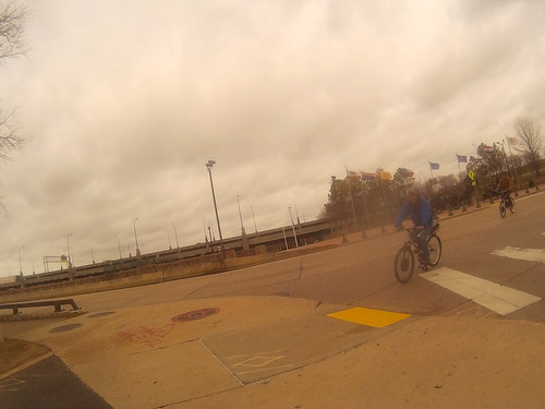
Way back on March 22nd, the wind and rain died down, the temperatures came up and I went on a bike ride. I wanted to to the Tulsa RiverParks loop of the Arkansas River which is a lot harder for now than it used to be because they have closed off part of the west bank trail due to construction of a new bridge and dam across the river. They divert the bike traffic out to Route 66 to share the road with dump trucks, oil haulers, and all sorts of other non-relaxing vehicles not to mention a crappy road surface. I’ve done it twice already since the construction started and it is not a nice ride on the detour. But hey, I wanted to do it anyway. So I strapped on my cheap gopro clone on my bicycle and headed out.
About a mile into it I almost had a collision with these two unhomed guys. They were coming in fast on an ill-timed left turn. Luckily I saw them and stopped. I already had one collision on the riverparks trails a couple years ago and it took me months before I could get on a bike again. I wasn’t mad at these guys and they were apologetic, they just got themselves in a jam.
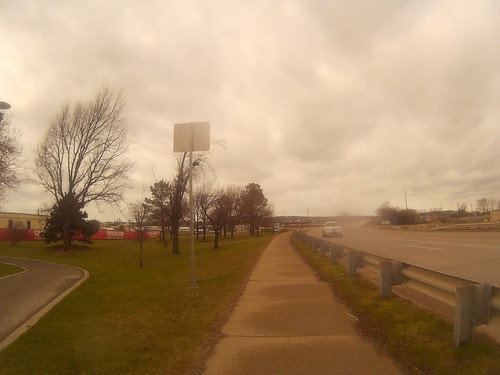
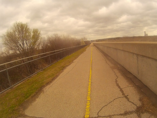
I got on the west bank and started going south. My strategy was to ride into the wind on the outbound leg so I could return to the car inbound. You can see from the flag how stiff the wind was. So I didn’t fight the wind, I was just moseying south.
And then had to leave the trail where it was blocked and head west on this sidewalk. Luckily there was nobody coming east. If there is someone has to give since there is not enough room for two bicycles or if a mom is coming with a stroller. I almost yield the right of way.
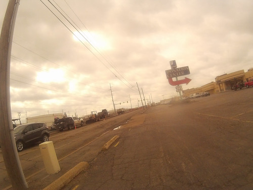
So I got to Route 66 and was planning on riding the sidewalk south, but no go!! Big construction project going on. Oh well, I crossed to the other side of the road.
They had four lanes of two way traffic squeezed down to two lanes and the bike lane is goine. See that truck. He’s in my space!! Luckily there was a decent sidewalk for a short ways.
And then I was able ride on the business parking lots adjoining the road.
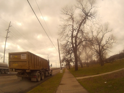
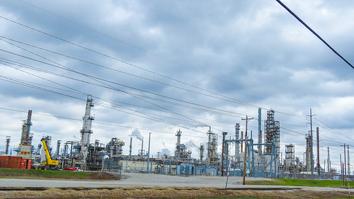
I got south of the construction and crossed the highway and came upon my favorite part. The road that the oil tanks use going to and from the refinery. Share the road guys!!
Another truck right going intot he refinery.
I brought one of my good cameras along and got a picture of the refinery. I know a little about refineries, being a chemical engineer and all. Mainly what you are looking for here is TST’s. TST stands for “Tall Shiny Things.” Sorry, I couldn’t resist. Other parts of the refinery have LRO’s which stands for “Large Round Objects.” You keep following my blog you are likely to learn a lot.
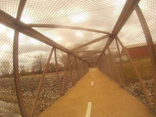
I always like this enclosed bridge over Mooser Creek.
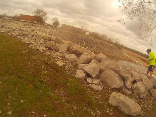
I stopped for a bit of geocaching here. I’ve looked for it before and and haven’t found it yet. The hint is “This cache rocks!!” Only chemical engineers have a worse sense of humor than geocachers.
And then on past the sewage treatment plant.
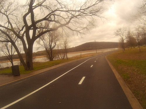
And then the long trudge up the trail to the lower parking lot of Turkey mountain.
And then we get to coast across the river to the east bank.
And then, flying north back to 21st street where I started. The wind was at my back and it felt like flying.