Tag Archives: Hiking

A Tour of Tulsa’s Lubell Park

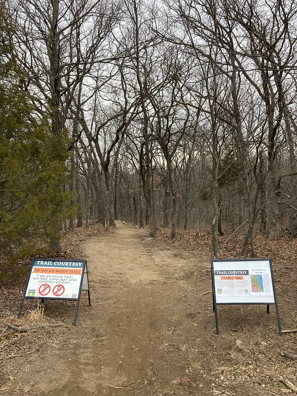
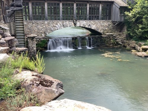
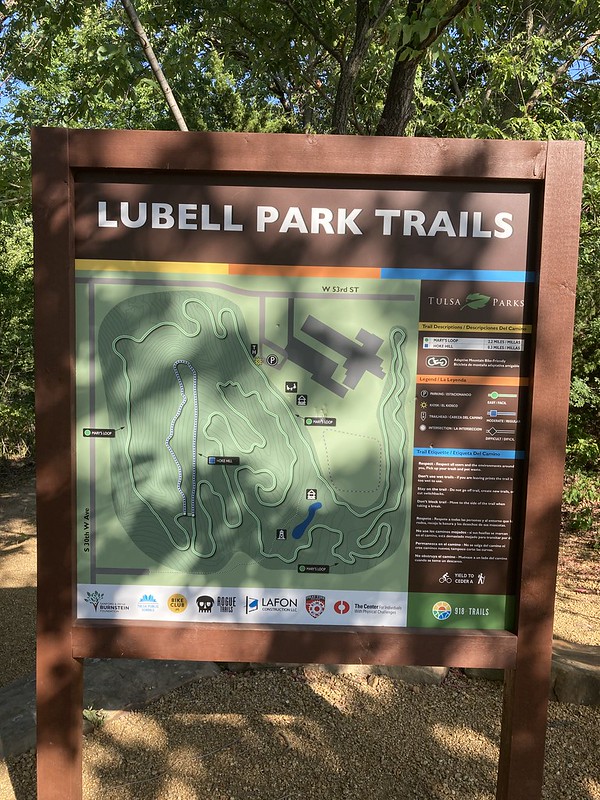
Last week after walking the new trails at Bales Park in west Tulsa, I drove ovder to nearby Lubell Park to check out their new trails. Their trails new to me but they had the grand opening on the new trails in October 2021. Before that they were hand cut trails by volunteers. The new trails were put in by the professionals at Rogue Trails out of Arkansas. The same people working on the Bales Park Trails.

DSCF0310

I’ve only been to Lubell one time before to find a geocache. What Lubell was mainly known for up until the new trails was the number and aggressiveness of their ticks.

DSCF0313

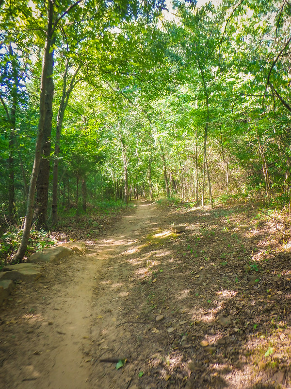
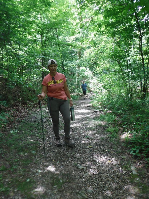
Ticks no more on these big wide, sustainable, cool trails. At least I didn’t get any (I use tick spray whenever I am in the woods.)

DSCF0314

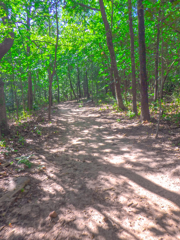
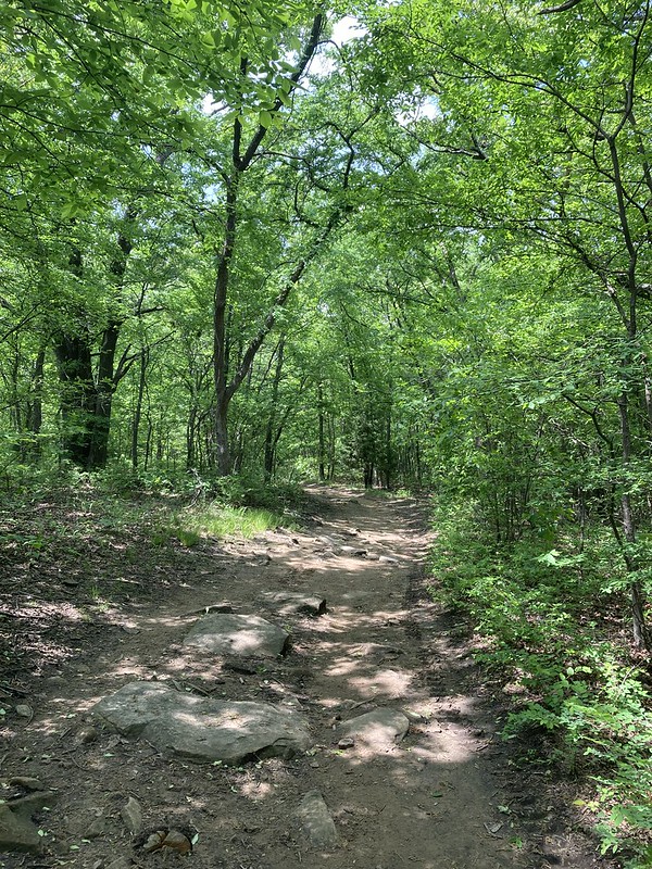
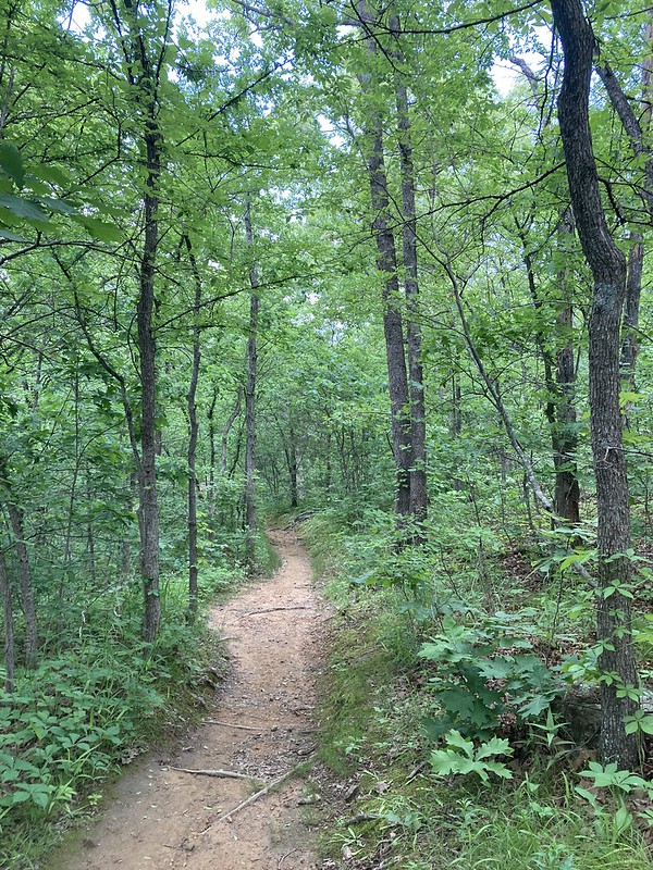
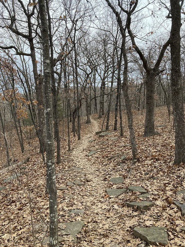
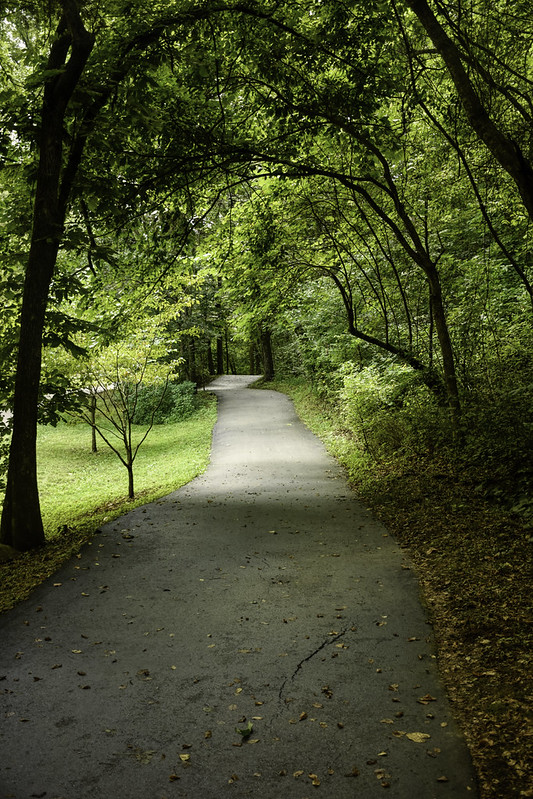
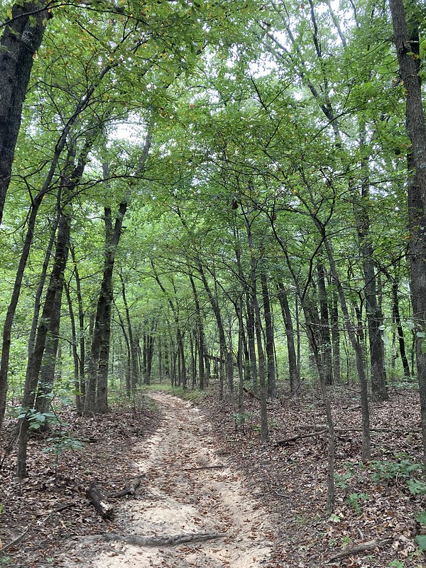
The trails are pretty cool. The project was sponsored by a local bicycle club and so the trails kind of cater to mountain bikes but they are perfectly hikable. These are the only mountain bike trails that I have seen in Tulsa that I think I would be okay with riding my bike on. Smooth, no steeps ups and downs, and doable turns. The new trails at Turkey Mountain and Bales are pretty cool but I don’t have the skillz necessary to ride them successfully. At my age, gravity is not friend! Can I get an Amen?

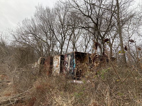
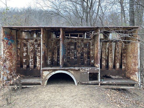
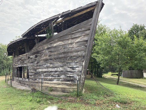
And they have some interesting features such as this shelter.

DSCF0312

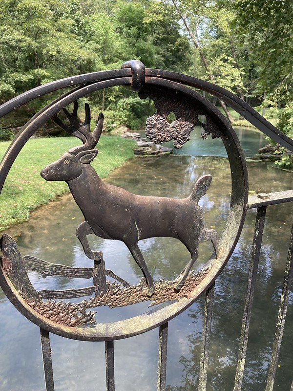
These look like thrones to me. Lubeell is integrated into the surrounding neighborhood such that some people have gates in the fences that open into the park. That is where I found these.

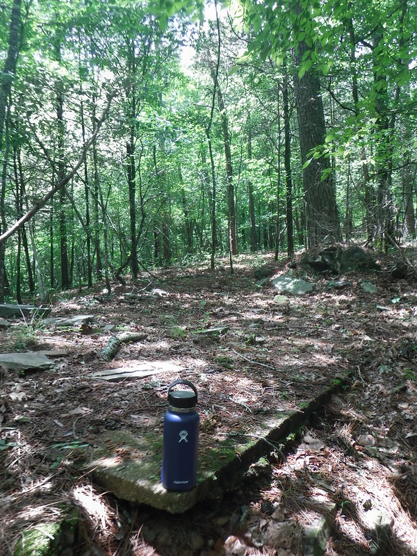
And they had several cairns or stacked rocks. I used to think they were cool but they don’t really go with a leave no trace vibe. They are not much of a problem in Oklahoma but some parts of the country are getting overrun with these and are technically illegal in National Parks.

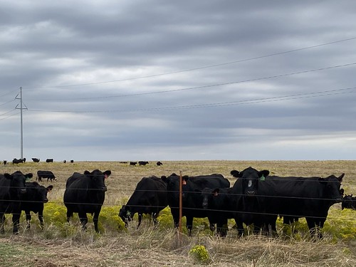
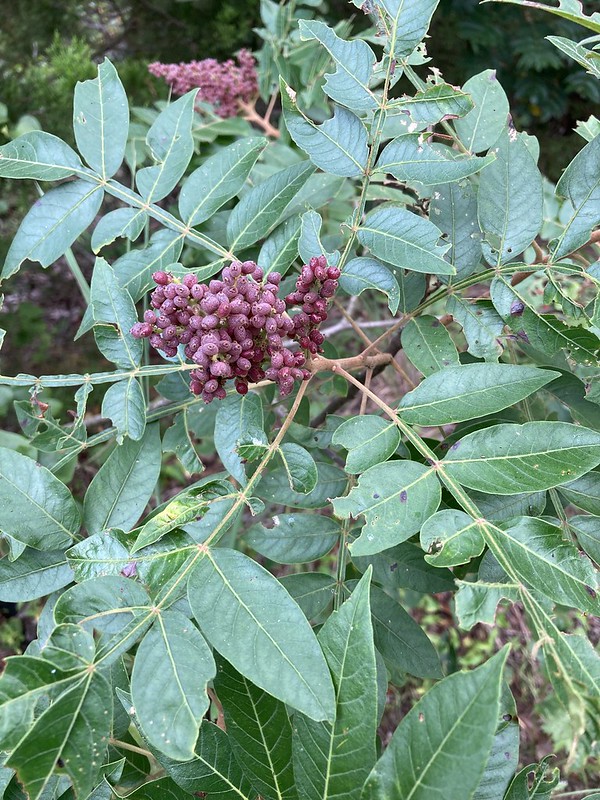
The east boundary fence appears to be a deer proof fence. I noticed a deer feeder on the other side. Notice the greenery. It is lespedeza, a noxious plant introduced to the United States from Asia in the 1890 and was widely used as a cover on non-productive soils. The problem is that it takes over and deer and livestock won’t eat it. I hate the stuff.

Moving on, near the end of the trail there are some nice obstacles mainly for bikes. I walked the little maze above.

More fun for bicycles.

And Tulsa has these things all over town. They are tornado sirens and many of them seem to be too big for the wooden pole that supports it and they are bending over at ever increasing angles. They send out three types of alarms. Tornados and chemical releases get a three minute monotone. Then there is a three minute wavering tone used only for nuclear attacks. So if you happen to be in Tulsa and those goes off, best just to kiss yourself goodbye. I remember in grade school in the early 1960’s we were told to get under out desks in case of nuclear attack. The third signal is a three minute high low tone. That is a flooding alert.

Sorry I digress, again. Here is a short video showing my hike at Lubell.

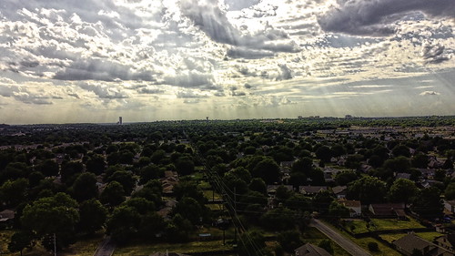
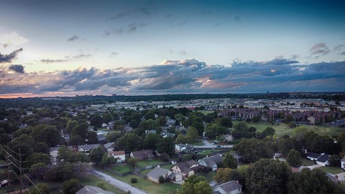
I’m linking with Skywatch Friday – go check it out!!

Skywatch Friday

DJI_0535-adjust

We had a break the other day with unrelenting heat and cloudless skies so I launched my drone from the back yard. These were rainless clouds but hey they shaded us a little bit. This is looking northeast from about 50 meters high.

DJI_0531-adjust

And looking straight west. Not a drop of rain in them.

"Holy Trinity Greek Orthodox Church"

I went downtown for some reason and ended up going by the Holy Trinity Greek Orthodox Church across the freeway from downtown. I love the domes that are on the Orthodox churches.

Tulsa Fire Station 4

And just down the street is Tulsa Fire Station 4 which is located right on Route 66 as it goes through town. They had a spiffy new (to me) Route 66 sign that I thought was cool. I posted it on Instagram and on a facebook Route 66 sign. Somebody from out of state asked if that was the only Tulsa fire station on Route 66. So I checked and no, there is one other Tulsa Station Fire Station.

Tulsa Fire Station 66, way out in city limits but in the country on Route 66. They call themselves “The Keepers of the Mother Road.” I thought I knew all the Tulsa US 66 attractions and no I didn’t. Check out their facebook page. They like people to come by and visit if they are not doing anything and host all sorts of school and other groups.

One of the things I do is water the monarch waystation on Tulsa’s Turkey Mountain. I went up there Wednesday morning and it had rained!! Not much of a rain but it soaked the parking lot. I didn’t feel much like watering after it rained plus the park had a contractor there laying down sod and I felt that they would probably be wanting to use the water tap and hose that I would be using so I just plugged and abandoned the project (oilfield lingo for giving up) and decided to go hiking. I’ll be back in a few days.

I went by one of the small lakes on Turkey Mountain on my hike. Something about skies and woods reflected on water really attracts me.

IMG_2807

Earlier this week I went on another bike ride on the RiverParks trails. I stopped and inspected the progress on the new pedestrian bridge and dam. Going pretty darn slow is what I think but I got a shot of the crane.

NASA’s Webb Sheds Light on Galaxy Evolution, Black Holes

And this is a photo from NASA from the new James Webb telescope that is taking some spectacular images of space. Click on the photo and you’ll get a description of what you are looking at. I’m still in the stage of just looking at the imagery, the text dulls the mind. (Sorry). They are letting everybody use the pics under a liberal creative commons license. Awesomeness is what I think.

I’m linking with Skywatch Friday

Hochatown Adventure – Second Day

_DSC0004

So last week I talked about our first day at Beavers Bend State Park in southeast Oklahoma. The second day we did a couple of hikes including the Friends Trail along the Mountain Fork River. This section comes off the bottom of the Broken Bow lake. The water is very cool and the state stocks it with trout.

_DSC0006

Several fly fisherman were on the water with their waders and long rods.

_DSC0008

I have done a little fly fishing but I was wishing I had a simple Zebco rod and reel, some worms, and a bobber.

_DSC0025

This guy was the smoothest fly fisherman I have ever seen. Hopping from rock to rock doing all sorts of casts into various pools. My late Father-in-law was a great fly fisherman. He could put a fly on one side of a rock or on the other side of the rock. Me, I was just lucky to get it out in front of me somewhere.

It is a very peaceful river and the day we were there were not many people.

We went to the park’s Forestry Heritage Center which has exhibits on the timber industry and culture of southeast Oklahoma. It’s a fun place with a 1960’s type vibe about it. They had a geocache there and Heather found it!! It had stymied us on previous trips.

I love this sculpture dedicated to Woodland Firefighters. It reminds me of my late father who fought forest fires early in his career in the forest service. He had the aluminum hard hat and a Pulaski, the combination axe and hoe the guy is holding.

We took my father to the museum years ago and I remember him showing us how these various chain saws and other tools were used in logging. I remember asking him why the yellow chainsaw had the saw blade horizontal. The answer was that early day carburetors couldn’t work work on the side so you had to hold the engine up straight while cutting trees or the motor would quit. So now you know!!

Later we went back to the cabin, drank a few beers, played some games, started a fire in the fire pit, made some smores and tried out the hot tub again. We had a grand time.

It was great for the three of us get away for a few days.

I’m linking with Skywatch Friday. Check it out.

Skywatch Friday – Getaway to Beaver’s Bend

Early last week we packed up the ole Honda Pilot to head off on a little trip to southeast Oklahoma. We were not going to be gone long but for some reason the car was packed full.

On the way we stopped in Antlers, OK for gas. They had this memorial to the Cboctaw Code Talkers of both World Wars.

We rented a nice cabin for a couple days. Nice big decks, a hot tub, a pool table and a pretty sizable out door area.

It had a baby Sasquatich inside. I love the corny things people do to decorate their cabins.

Heather playing ladders. We also played cornhole, swung on the swings, and used the fire pit and the hot tub.

We brought along our elderly Pomeranian, Rascal and he seemed to have a great time as well. We went on daily one mile walks with him and he practiced going up and down the steps to the porch.

We grilled a lot of food and spent a lot of time together.

DSCF0228

The next day, we loaded up for a hike (Rascal stayed at the cabin) and went for a three mile hike on the Mountain Fork River. A very nice trail that is relatively flat.

DSCF0230

We didn’t see hardly anybody the whole time.

DSCF0234

The weather was sunny and cool. That’s Logan in blue to the back.

DSCF0240

At the end of hike we came across a collapsed old building with just the foundation remaining. I love mysteries like this? I’m gong to have to found out what the deal is.

Anyway, that was just the first 24 hours. I got more to tell later.

Sad news from Tulsa today. A gunman barged into a medical office building and killed four people before taking his own life. The Tulsa Police Department was on the scene three minutes after the call came in. They ran up to the second floor where the shots were coming from but they were too late.

Take care I’m linking at Skywatch Friday.

Skywatch Friday – Outside Time!

I got it all on this week’s post, Gardening, Hiking, Bicycling, A Plea for Help, and a Musical Finale! Are you ready? Lets get started!!

Earlier this week I went to Turkey Mountain. We’ve had a lot of rain and they want people to stay off the trails when its muddy. Kind of like your Great Aunt Grace telling you to stay on the plastic runners. Or at least that’s what my Great Aunt Grace would tell me. Anyway I first checked the Monarch Waystation. Lots of green stuff there and few blooms.

I’m no butterfly but if I were I guess I would be digging into whatever these flowers had to offer. My botanical ID skills are woeful. I do know that these are yellow blooms. Enough Gardening, and now Hiking!!

And then I got back in my car and drove up to the upper parking lot. Ordinarily the I would have gone up the trail but I was rationing my energy because the temperature was over 90F and the head index was almost 110F. Anyway, I started down the Snake Trail to go explore the NW side and see if there were any new trails out that way.

The Snake Trail is pretty decent. When I take first time visitors to Turkey Mountain, before the new trails were started, I took them on Snake because it was relatively flat and not very technical (in other words breaking your ankle was unlikely). Turkey is going to have a mixture of old and new trails. The terrible erosion prone, non sustainable trails will be blocked off to allow the ground to heal.

I got up close to the YMCA and headed east and soon came to some new trail that I had not seen yet. So I jumped on it and went a couple hundred yards or so and saw that it was not yet open. I thought it looked a little rough. Anyway I got off it and got on a parallel old trail.

I emerged on what is called the Powerline Trail and went back to the parking lot. Powerline is difficult. It gets kind of technical and really steep and has several false ridges. I guess you could call it Heartbreaker as well. It is in full sun which makes it extra fun on a hot sunny day. But hey I made it. I guess you already figured that out because I wrote this post.

And now the Bicycling Segment!!

Thursday morning, I got up, skipped yoga and took my bike out on the other side of the Arkansas River to ride the paved trails. That hill you see on the other side of the river is Turkey Mountain. Don’t be giggling or laughing at the Mountain. We don’t have too many in Tulsa.

On the south end of the RiverParks trails is a Native American Tribal owned casino. The trail squeezes in betweenn casino and the river. Somebody, maybe the tribe has been doing some “Riparian Mitigation” on the riverbank and it is bearing fruit. I never noticed these trees before. I love it.

On the north end I stopped at the south end of the Gathering Place. With better weather people are taking their toddlers there and they let the kids migrate into the bike lanes. I don’t blame them, they are new to the trails and don’t understand. Anyway, when the new people I just cut my ride short and go back. Better than risking hitting somebody. But I stopped and smelled the roses

Do I look like I need help? Well I do!! Come volunteer at the Tulsa Ironman race on May 22nd.

DSCF0569

Last year I volunteered on the running segement on Sunday afternoon. It was fun and easy. I just handed out water and gatorade to the racers for several hours. These men and women are amazing athletes. The Tulsa Urban Wilderness Coalition gets paid for the volunteer hours they provide to the event. Check here to get more info if you are interested.

And the musical section of this mess of a post. Featuring a hot mess herself, Miranda Lambert. I got her new album Palomino and am loving it. She is a good singer and has quite the sense of humor.

That’s about it folks. I guess I had some sky photos in here somewhere. I’m linking with Skywatch Friday. Come join in!!

Our World – the Mysteries on Turkey Mountain

Things have really been busy lately.

Someone close to us got covid and by some miracle, they got right into the emergency room of the leading hospital in Tulsa. They got some great care and will be returning to their home soon. Please be careful folks.

I went for a weekday hike on Turkey Mountain a couple weeks ago. I had the place to myself. I saw two other people in my hour and half and three plus miles. You come on a weekend there are a lot more (unless you know where to go where nobody else is.)

I started down the new trail and then veered off on a small leafy trail paralleling the new one.

I veered back to the new trail to check out this cutout of bigfoot. There is quite a bigfoot culture in Oklahoma!!

I left the new trail and headed west. I came upon a bunch of old cans and rusted pots on the ground and I noticed this pipe hung up in the tree.

It has been there so long that one end is embedded in a tree. It looks to me like a really old camp site. Turkey Mountain has been populated by Native Americans, farmers, ranchers, railway men, oilwell drillers, and supposedly moonshiners and more lately meth labs. Who knows the vintage of this camp!?

A littel further west I came to Pepsi Lake. What are called ponds elsewhere in the world are lakes on Turkey Mountain. Don’t ask me why. Don’t ask me why these Pepsi truck bodies are perched on the Pepsi Lake Dam. The Pepsi
Bottling Company is nearby so there might be some sort of connection. So people tell things like that Pepsi put the bodies up there to protect the dam. They don’t know that, they are just guessing. How would that protect a dam anyway.

It does provide shelter for homeless people (not for very long, it is a long walk to civilization from Pepsi Lake. You can tell people have had parties of very sorts at the site.

And there is some decent tagging there. Please though, take your graffiti elsewhere.

It’s a mystery that I haven’t figured out yet.

Another mystery is this thing on the west side of the mountain. Not too many people know about it but I’ve been told it is an old moonshiners camp other people have said outlaws hung out here.

A friend of mine piped up and said he knows an old timer that lives close to the mountain who knew all about it. He said that it’s an old hunting camp. Wow, that’s boring. I’m sticking with old moonshiner’s camp! Who’s with me?

Turkey Mountain Hike Strava Map

So here is a little map of my travels. I started down at the bottom and went counterclockwise. Like I said I didn’t see hardly anybody. Being retired is fun, going at off times.

I am linking with Our World Tuesday. Come join the fun!

Geocaching at Oklahoma City’s Bluff Creek Park

Son Logan came to visit for Fall Break the last several days. We loved having him and Monday it was time to take him back to college. So we loaded up his laundry, his groceries, and all his various devices. (He has lots of devices, and they are heavy) and flew on down the Turner Turnpike and then down south of Oklahoma City to his college. We got there at about noon, so we unloaded his stuff, and he put on his backpack and said bye Dad. Okay, bye son. He has class at one and pizza for lunch, I get it. So off I went.

Johnny's Hamburgers

I flew back up the turnpike to Oklahoma City to Johnnies Hamburgers. Oh my gosh, best hamburgers that I ever had. Texted this photo to my wife. That was NOT a smooth move. You would think after 32 years of marriage I would stop doing crap like that. She thinks so to.

Off I went to Bluff Creek Park in Oklahoma City. I geocached here years ago when it didn’t even have a name. I remember for it great trails and lots of deer and great geocaches. Guess what it still has great trails and deer. The trails are for mountain bikes and they have “directions” oh well, I was on foot like most other people and I’ve spent my whole life not following directions.

I was looking for five caches. You see, I have 1994 caches and I was looking for five to get to 1999 because I have a “milestone” cache in mind for Tulsa that I was going to get Tuesday.

Found this tortoise, but not the nearby geocache.

The geocaching gods had other ideas. I looked for six and found two. One doesn’t count because I could see it but it was way up in the air and I couldn’t reach it so it doesn’t count. The other one I found, and it counts so I stand at 1995 so I have to rethink my strategy. The geocaching gods punish hubris severely.

But hey, its all good. A great time outside wibble wobbling in the park in the sun under a great blue sky. I saw three deer and a bunch of squirrels and not very many people.

Here is a map of my wanderings. As you can guess the thick squiggles is where I was looking for something.

And my geocaching map. The frownies, are caches I didn’t find. The yellow smiley is one I did find. The green one is the cache I saw but couldn’t reach. The other two blue markers, dark and light, and different types of caches that I was not looking for. But hey, I found the one!!! One is better than none in my book. Best thing was a a great time in the woods.

Have you ever been geocaching?

Skywatch Friday – The Skies of October

I’ve been enjoying my October so far. The weather has been good and I have been doing a lot of hiking and wandering. Above is the sky over Lake Bixhoma south of Tulsa about ten miles. I love it there during the week because nobody else is there.

This is a photo taken by “cousin-in-law” in western Oklahoma of Angus cattle on their ranch.

And this is at Martin Nature Center in Oklahoma City. I stopped there for a short hike on my way to pick up son at his college.

I’ve shown these chairs before. The City of Bixby repurposed the old auto bridge across the Arkansas River to a pedestrian bridge and added all sorts of extras such as these recliners.

And of course I had to try them out.

Here is the view I had.

History Marker

The bridge ties into Washington Irving Park in Bixby where the man camped during his tour of what is now Oklahoma back in 1832.

And here is sculpture of the man. This is part of an outdoor amphitheater. The park is another good place to go during the work week cuz of hardly anybody else being there.

And this always makes me think and ponder. This is one of the girders from the World Trade Center that were destroyed on the attack on America.

So I’m really enjoying the moderate weather. How about you?

Come join me and and bunch of other photobloggers at Skywatch Friday

Late night bonus content – I flew my drone for a little while this evening.

drone 15 nik

Roughly a little south of northwest. All these were taken at about 150 feet elevation.

drone 14 nik

Looking almost straight west

drone 13 nik

Roughly a little north of southwest.

drone 12 nik

A really big cloud was passing over Tulsa. This is looking almost straight south.

drone 10 nik

A little bit north of northwest.

drone 11 nik

Almost straight north.

I flew the drone in “periscope mode” in other words I launched it straight up from my back yard and just rotated it and snapped a few pics.

Our World – Hiking at Dogwood Canyon Nature Park

_DSC0607-adjust

On the last day of our recent mini-vacation to Missouri we stopped for a visit at Dogwood Canyon Nature Park. 10,000 acres of wilderness set in a beautiful canyon in southwest Missouri. It was founded by Johnny Williams of Bass Pro fame and is a non-profit outfit.

_DSC0608-adjust

One can walk the three miles of trails, or ride a bike, or take a guided tour in a pickup pulled trail. We like walking so we walked or rather Heather walked, and I sauntered behind taking lots of photos and Logan was in front of me and behind her. We kind of do our own thing.

I love the trail markers. Johnny Morris really works on branding on his Bass Pro properties and you can see his influence on a number of things at Dogwood Canyon.

_DSC0613-adjust

There is a creek that runs the length of the property. It has a bunch of pools separated by waterfalls. The pools were full of big fat trout. Did I say that you could go fishing there?

_DSC0601-adjust

The canyon is full of features for photographers. Lots of beautiful scenery and the stream provides lots of opportunities for reflections. I would love to be here during the fall color.

I love all the little touches on the trail.

These markers on the various bridges are all works of art.

_DSC0598-adjust

There are just so many things to look at.

A huge building is the entry to the park and has displays on early American and Native American relics from the area.

We’ll be back.

This is the second visit here for us. Check out our first visit to the Canyon three years ago. I’m linking with Our World Tuesday, check it out.

Our World – On the Trail and the Road

Sunday morning after dropping the kid off at work I headed to Turkey Mountain for a little hiking.

Virginia Creeper?

I’ve been reading the novel, The Overstory by Richard Powers and it is blowing me away with its talk of how trees in a forest are all interconnected and they exchange nutrients with one another and with other plants via a network of fungal hyphae, miles and miles of tubular fungus that exchange minerals with trees for sugar. I already read the book and then I started reading it again. It’s pretty amazing.

Hairy Ruellia?

The woods on Turkey Mountain are very new. It used to be small farms and ranches but oil was discovered and what trees that were there were cut down for fuel for the boilers that powered the pumps.

Headache!!! I’m afraid some poor mountain biker hit his noggin.

So the trees that are there now are pretty new and mostly skinny. There are a few older ones that are bigger and are more spread out. I find the whole life cycle of tree thing to be fascinating.

American Trumpet Vine maybe

I know that Sunday I pretty much had the place to myself. Most people on Turkey Mountain stick to the more established east side with its overlooks of the Arkansas River and well developed trails. The west side is a little wilder and the trails less established and mapped.

I went all the over the the YMCA and took a pic. Not much going on there.

Shining Sumac perhaps

Just 3 miles but hey I was refreshed.

In the afternoon I checked out Route 66 for some geocaching. I stopped one of my favorites. The Blue Whale of Catoosa.

Right next to it was this. Apparently it is supposed to be an Ark as part of a journey through the Bible attraction but it didn’t really take off.

I found this museum in Catoosa. It was closed but it has a great mural out back.

And this is an old bridge on Route 66 that has been relocated. So I am continuing my turning 66 on Route 66 thing that I have going on.

I hope your Sunday was as fun as mine!!

I am linking with Our World Tuesday