This is the beloved Pedestrian Bridge across the Arkansas River that I posted earlier. I posted a similar photo on the Abandoned Oklahoma facebook group and boy talk about a strong response. Most people want to keep it and are outraged that nobody got any notice. Seriously folks, its been in the news for three years. It’s a little late because the demolition contractor moved this last Monday. I got messages asking if it would be possible to get a bridge section. I don’t know folks, I’m just the picture taker. Call the River Parks!! I’ll miss the bridge but am looking forward to the new one.
A play castle at Tulsa’s fabulous Gathering Place. Oh to be a kid again.
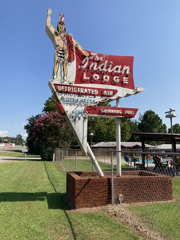
A cool sign on the drive to Sequoyah State Park. I was by a year or so ago and the motel was all run down with a for sale sign. It sold, the place is spruced up and it looked like they had a lot of people there. I love it.
And a 90% full moon. We had a big bright moon, but it wasn’t full but with rain in the forecast I went ahead and took this photo.
I hope that everybody is staying healthy. Here in Oklahoma, Covid is surging and our Governor is not really doing anything about so our family is still hiding out, wearing our masks, and avoiding clusters.
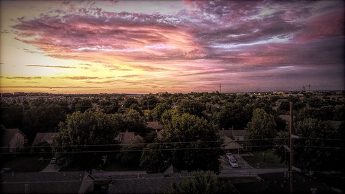
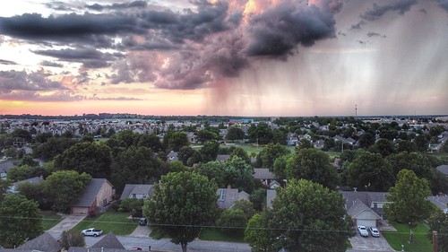
We had some color in the sky the other day so I fired up the drone and sent it up from the back yard. The color was not to the west because there were no clouds. The above shot is to the north.
This is to the east.
And northeast across the greenbelt.
I am thinking about the victims of Hurricane Laura which made landfall early Thursday morning in southwest Louisiana and is still causing damage far inland as I write this.
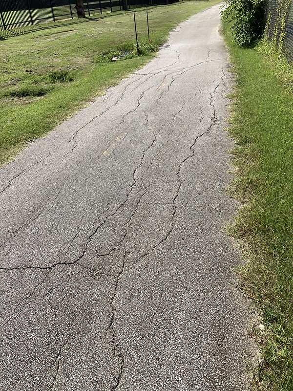
The past week I’ve been walking the paved trails in Tulsa and suburbs checking out the condition of the pavement. INCOG (“Indian Nations Council of Governments”) asked trail users to participate so they can determine the condition of the various trails. INCOG is an agency that works with the various city and country governments on infrastructure planning and coordination.
This section has it all, transverse, longitudinal and alligator cracking.
They gave us a cool GIS (“Geographical Information System”) app on our phones to report what we find. Plus we got some materials on what to look for. So I have found out about longitrudinal, transverse, and net cracking along with skreveling and other technical terms.
Easy to find, hard to open. Bring Deet and don’t come if you allergic to poison ivy. Pro tip, if you don’t know if allergic to poison ivy, just assume that you are.
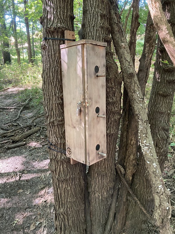
I’ve taken the opportunity to chase after a few geocaches in the adjacent woods. This one is a “gadget cache”. Easy to find but hard to get into. I pondered this one for a several minutes before I figured out what to do then about 20 minutes to open it up, sign the log, and put it back together.
Here is another one that I found. Unfortunately it has been vandalized by somebody so it didn’t work right. Gadget caches are all the rage now in geocaching.
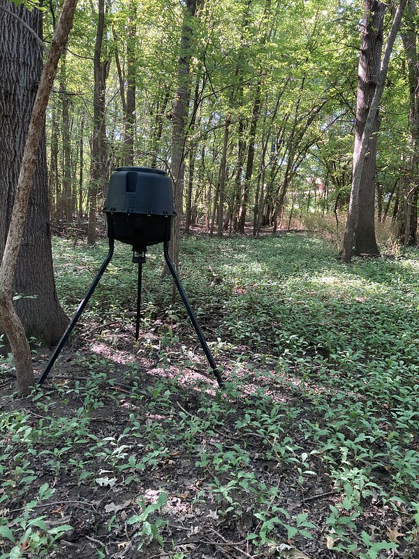
I also found this deer feeder deep in the woods on public land.
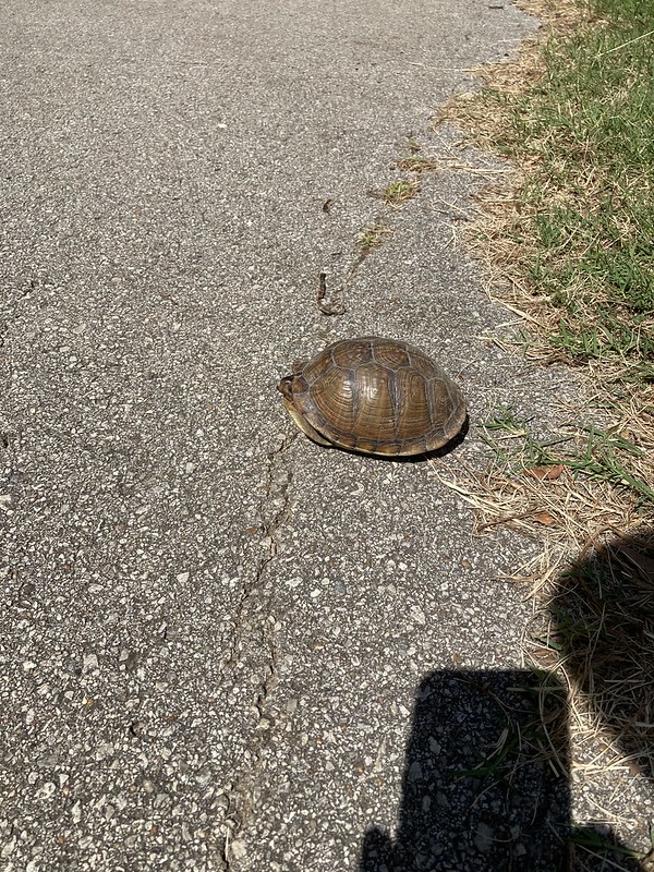
And I did a daily good deed in helping this little old turtle across the road like a good former boy scout.
So far I have only done about 4 miles. That takes 8 miles of walking because I have to walk back to my car. Not too many loops of reasonable distance. There were about fifty volunteers I am guestimating but it doesn’t look like very many of them are actually doing anything. There is about 200 miles of trails all told, I think.
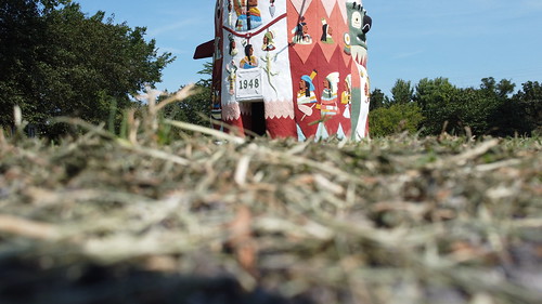
On another note, last week after I went to the Will Rogers Fly-In I drove over to Ed Galway’s Totem Pole Park near the small town of Foyil. I had been there before but this time I took my drone so I could take a better look.
It is right off US 66 and is a must see stop if you are touring the highway.
It was built by a guy, Ed Galway. The main totem pole was built by him between 1937 and 1948. The park has other totems but on this trip I was just interested in the main pole. I think this is my third trip to the park. Here are some links of previous posts.
Ed Galways’s Park is one of my favorite Route 66 Stops. It is so over the top and unique. And it is free!! I like free. They have a gift shop. Go get a cap or something.
Ginger, RIP
And finally, our beloved Ginger went to the big puppy park in the sky yesterday. She was fourteen years old and had multiple issues. She is in a much better place now. Our critters just don’t live long enough.
After a dry June things have been rainy in July. Makes for green country side and interesting skies. Northeast Oklahoma is called Green Country for a reason.
Here’s a shot from directly over our house to son Logan’s first elementary school less than a block away. Remember when schools were open and had classes. Good times right! The state of Oklahoma is letting every district decide for themselves how to handle the coming school year and it is amazing the variety of programs the administrators of the various districts have come up with.
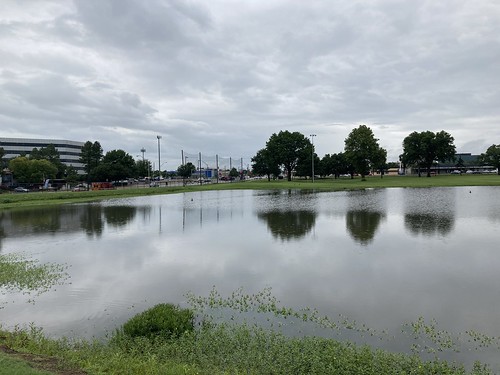
Went on a walk yesterday at Lafortune Park and got rained on a little bit. I don’t mind, as long as I can keep the phone dry.
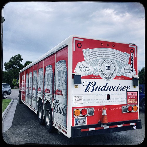
Here is a beer truck Skywatch shot. Too bad it is crap beer.
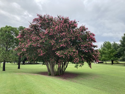
Lafortune Park has the prettiest crepe myrtle I have ever seen. It has all sorts of room to itself and gets full sun all day long. I think the staff has been taking very good care of it as well.
Son and I took the drone to north Tulsa’s Reservoir Hill subdivision and took some shots of the Tulsa Arrow. The Tulsa Arrow was originally put up for Charles Lindbergh’s transcontinental flight to show the way to the airport. Apparently all sorts of cities put arrows for that purpose way back when. A few years ago the subdivision’s residents recreated the arrow. You can see the story here. I think it is pretty cool. I have a geocache nearby.
That’s it for this week. I am linking with Skywatch Friday. Come join in!!
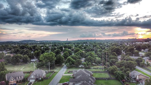
We finally started getting a little weather here. So I have been flying my drone in periscope mode where I launch it from our house and go straight up.
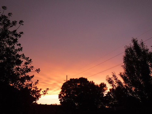
This is looking west at the sunset.
Some rain to the north of the house.
Another day’s sunset.
Here’s the drone pilot wearing his favorite flamingo shirt. He’s got a haircut since this photo so he’s not quite as shaggy. I’m not one of those dapper retired guys who are all buttoned up. I haven’t ironed a shirt since I retired.
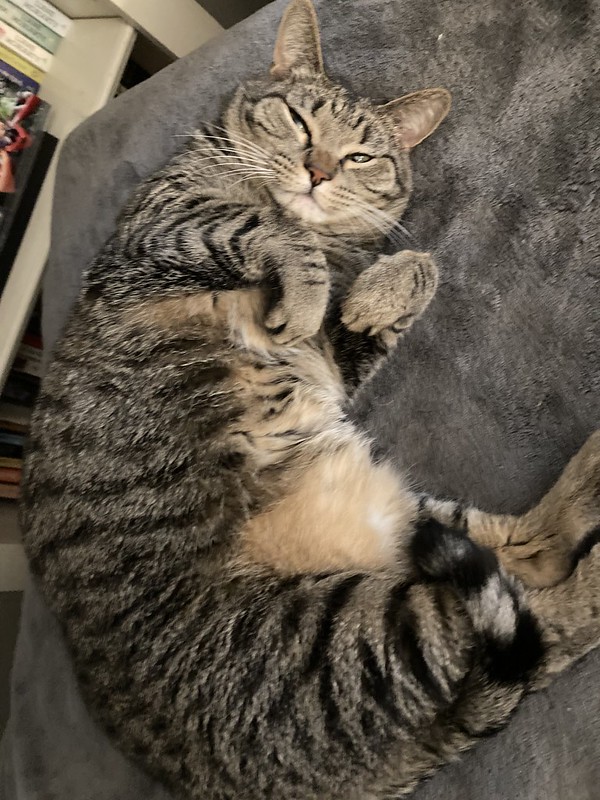
Switching gears, hear is Lizzie the kitten after I woke her up from her nap. Miss Lizzie is getting kind of fluffy from all her eating and napping. Not that I am trying to fatshame her or anything.
And I can see!! My first optometrist exam in two years. My prescription hasn’t changed in three years. I was prepared to get new glasses but I’m sticking with what I got for now. Not only am I a scruffy old retired guy, I’m cheap as well.
I went on a bike ride and passed these oilfield heater treaters all trailered up and nowhere to go. Heater treaters are used to separate crude oil, water, and natural gas after the liquids come out of the ground. Most wells produce all three at the same time. Blood, guts, and feathers is what I call it. Heater treaters use heat to help with the separation. The fact that they are sitting there and have been for some time is not a good sign for the energy industry. Somebody is paying some pretty steep storage fees.
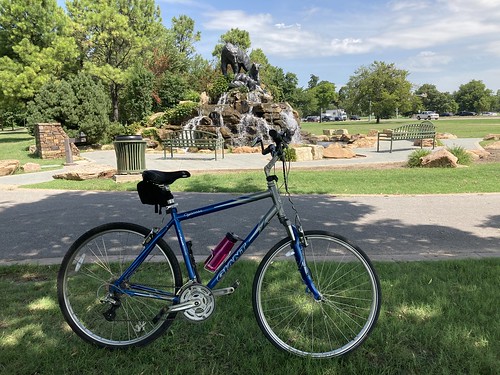
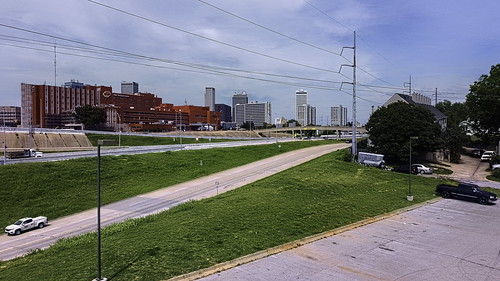
Here’s a view of downtown Tulsa from the bike path.
And at the end of my ride. I love that bear fountain. You notice I am admiring from the shade. It was close to 100 F when I finished.
So everybody, be safe, be kind, and take lots of sky photos.
Earlier this week I ventured out to Turkey Mountain for a little three mile run. Or rather I ran a mile and my knee started twinging I than I mainly walked. Basically I had the whole place to myself.
Powerline Trail
Turkey Mountain is an Urban Wilderness nestled right up to the City of Tulsa so yep, it’s got three sets of powerlines on it. Two in parallel going north and south and one set going east and west. So my photos have them included. It is what it is.
On the Yellow Trail (I think)
I love all the trees on Turkey Mountain. This one is spreading out.
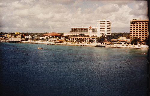
Playa del Carmen maybe?
I’ve been scanning old photos. This one is from a cruise Heather and I took back in 1992 I think. We went on a cruise form Miami and made various stops. I don’t remember where this stop was but I love the sky and the water. Let me know if you recognize it from some of your travels. Right now I am scanning photos still in the envelopes, not in an album.
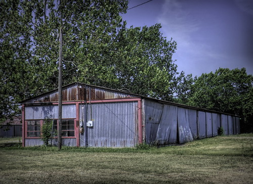
I was out geocaching in east Tulsa the other day when I noticed a sign for Harvey Young Airport. The name sounded vaguely familiar so I drove down the road until it dead ended into the airport which had no gate or fence but a big No Trespassing sign. I always respect those and so stopped and took a couple of photos. There was not a whole lot to take photos.
There was this old hangar. I posted this on Forgotten Oklahoma facebook group and somebody responded that it once housed an aircraft mechanic’s facility. The glassed in part was the office and the rest of it was where the work took place.
The airport was started by a guy named Harvey Young who landed in a pasture back in 1940 and ended up buying the land. It became a base for training military pilots during World War II and then reverted back to General Aviation afterward. Somebody bought the airport and announced big plans in 2017 to demolish the buildings and build new and cater to vintage airplanes. It doesn’t look like much has happened since then. The developer still has his web site up.
This was the only aircraft I saw. A Beechcraft Bonanza. They have been in production since right after World War II. The V tail is its distinctive feature although there are Bonanza’s out there with the conventional tale. I found out that the Bonanza is also known as the Doctor Killer because it is a very expensive, high performance aircraft, and lots of professionals like doctors buy them but don’t have the necessary skills to fly it. Someone who is a pilot and has flown it told me that the V tail model in particular is very hard to control if you get into a spin.
A brand new Bonanza will cost you about one million dollars.
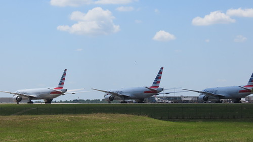
I was poking around the backside of the Tulsa International Airport last week. (You know old retired guys, we like poke around stuff.) These are just a few of the dozens of passenger aircraft that are parked on every spare space at the airport. I talked to a guy in the airline industry yesterday who said airline travel is down 85% from a year ago. Tell you what, I’m not getting on airplane until this pandemic has calmed down quite a bit.
I found this. I thought it was an old fuselage section. I put it on social media asking if anybody knew. One guy said it has been out there for at least twenty years that he knows about. A few people said that it was used for fire training. Another guy said that if was really a fuselage it would not have survived fire training because aluminum would melt. That made a lot of sense to me. He said further that the training fuselages are specially built out of steel.
So whatever it is, I don’t think it has been used for a long time and it might make a great geocache site. Except you know, even though I was not in the security perimeter of the airport I had the heebie geebies, I felt that I was being watched. I hate being stopped by cops or security guards and I would not like to put somebody else in that situation.
I was going to add this to last week’s post. It is the not quite full Strawberry Moon. That’s me, a day late and a dollar short. But here it is.
As many of you know I retired recently. One of the perks of my job was being able to take photos out the windows. So here is a badly done shot, the last photo from my office building. But don’t worry…
I got a drone, so as long as its not too windy and I am not in a drone no fly zone I can pop up and take photos any time I want. So hey, it all worked out for the good.
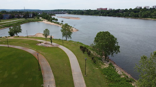
I felt like flying the other day so I took my drone to the west side of the Aransas River and flew a little bit. The video above looks like kind of hurried but when I was making it, thought I was going very slow. Part of the learning process.
And I took a photo of the running and bicycle trails.
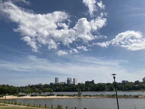
A view on the east side of the river looking upstream to the northwest.
And then almost a 180 turn, looking toward downtown Tulsa.
And here’s the pilot, a retired slacker. You can tell by the untucked shirt.
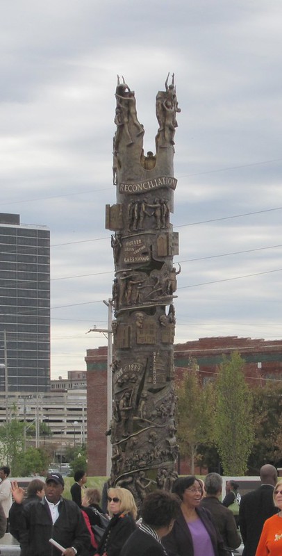
Tulsa’s Reconciliation Park at its opening years ago.
And of course Tulsa, like lots of other communities across the country, and the world, had protests over the George Floyd murder. They are not only of course protesting the murder but protesting how people of color are treated by the police in general. I didn’t attend any of the protests which by all accounts lively and peaceful. The events were marred by vandalism and looting by a small number of people generally after dark.
The protests came at a poignant time for Tulsa. May 31 was the 99th Anniversary of the 1921 Tulsa Race Massacre where a white mob descended on the black area called Greenwood north of downtown and burned it to the ground. Several dozen people were documented killed and suspicion lingers that there were far more. The Tulsa History Center has a web site dedicated to the event. Nobody was ever charged with any of the crimes and there was never any reparations. The survivors just had to suck it up and survive. Here is a link to a post I wrote on the subject.
It’s a scar that still affects life in Tulsa today. Of course many people think we should ignore it but personally I think it needs to see the full light of day, otherwise we will not have learned anything.
Went downtown the other day and brought home personal stuff from the office. The office has been closed since the middle of March and won’t open, at the earliest until the end of June. The only people working there are a cleaning staff and a security guard. Plus our pipeline control people which is staffed 24 hours a day. They have spread those folks all over the building to avoid cross contamination in case Covid-19 gets somebody sick.
I realized that yes, I am going to miss the job and the people, and I am really going to miss downtown. Weather permitting, I walked a mile to 3 miles every day at noon and poked into every square inch. I’ll be checking out from time to time. On weekends, when parking is free, cuz I am cheap.
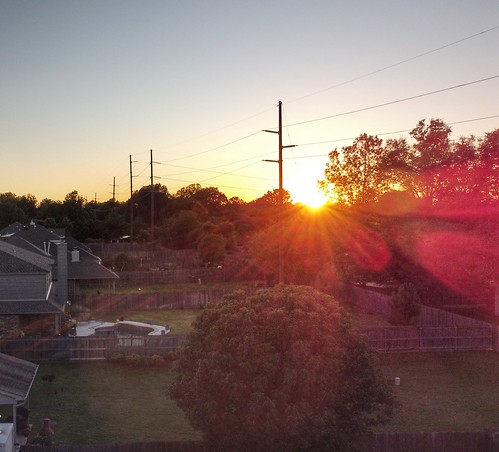
Lots of nice evenings as the sun sets in the back yard.
Watching the weather. I love weather watching. Everybody in Oklahoma stays aware of the weather and watches the skies this time of year. We are all very conversant with terms like hook echos and such as that.
Lots of walks in the neighborhood for our dog Rascal. He kind of walks us is how it works. He routes us by all his friends.
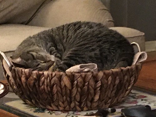
Our tubby little kitten, Lizzy is wondering why everybody is around all the time. It interferes with her napping. She’s appropriated this basket that Heather was going to use as a centerpiece on our coffee table. So I guess that Lizzie is the centerpiece. It is peaceful to me watching a cat in deep sleep.
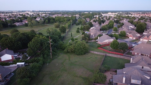
The greenbelt from our back yard. I fly the drone straight up mainly. I don’t really want to fly over other people’s property. So I send it straight up and use it like a periscope.
So Oklahoma is gradually opening up. Heather and I went to our favorite tap room and had a couple beers in their outside area, maintaining extreme social distancing from everybody else. The gyms Heather teaches are opening up as well and they are communicating protocols for staff and members. Myself, since I am in a high risk group I am holding off going to a gym until July. I’ll be playing it by ear.