Tag Archives: Tulsa History

Saturday’s Critters – Seen on a Bike Ride

I went on a bike ride the other day on Tulsa’s Riverparks Trails during a very unseasonably warm day.

IMG_3209

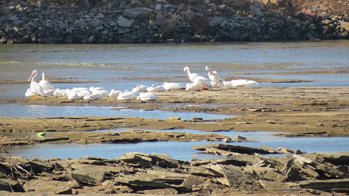
I saw two groups of white pelicans on the river. They were both all hunkered down. I hope that they will get going to where they need to be for the winter.

IMG_3211

The canadian geese are here all year long in Tulsa. Many of them still migrate south but I guess the others have figured out what some of politicians haven’t, that global warming is a thing.

IMG_3212

And I saw a few great blue herons. They are everywhere. Back in the day when I still worked I was out in the natural gas fields of western Oklahoma and I stopped on a dirt road to make a cell phone call and suddenly noticed in the field next to where I parked there were a bunch of great blue herons. Not in a pond or water, just standing there in a field. I took a pic but it is long gone. Well before the days I knew about storing and tagging and all that other stuff.

IMG_3221

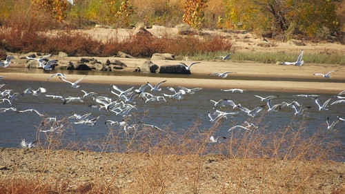
I found a bunch of seagulls clear across the river.

Turkey Mountain Colors 2

I stopped and took a photo of the foliage on Turkey Mountain across the river. I never get tired of seeing it.

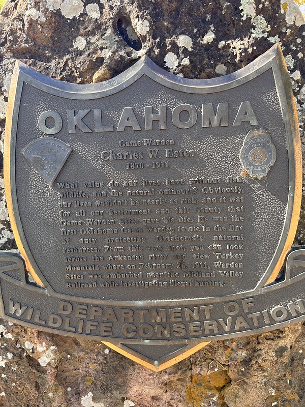
Plaque

Nearby was this plaque commemorating the first Oklahoma Game Ranger killed in the line of duty. He was game ranger murdered in the line of duty in Oklahoma. On Turkey Mountain investigating a poaching case. I don’t think it was ever solved.

Back in the day, Turkey Mountain had a bootleggers, lawmen, oil field hands, ranchers, railroad men, and farmers. I have personally found “shake and bake” meth labs. It has a shady past. So does Tulsa for that matter. Machine gun Kelly, Pretty Boy Floyd, John Dillinger, Bonnie and Clyde, Ma Barker. They all have Tulsa ties. Read more about Tulsa’s shady past here.

Oops I digressed. I am continually fascinated by the dichotomy of Tulsa. On the east bank are big companies, operas, ballet companies, symphonies, wonderful museums and on the gritty west side, like Turkey Mountain, refineries, oilfield manufacturing, factories is where the money was made to pay for all the nice stuff. That is where the outlaws hung out.

I’m linking with Saturday’s Critters.

Oops one more thing,

Excuse my appearance, I’m retired so I get kind of scruffy. That is me, (of course) and Lizzy early in the morning. I read the paper and drink coffee in the morning and she reads over my shoulder. I keep telling her that is rude but she won’t stop.

Tulsa’s Greenwood Rising Museum

About a month ago I checked out the Greenwood Rising Museum in the Greenwood District of Tulsa just north of downtown.

The museum opened to visitors in August 2021 a little over a 100 years after the Greenwood Massacre in the same area.

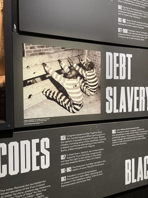
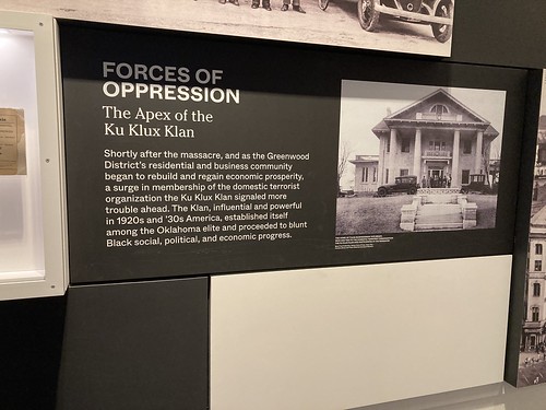
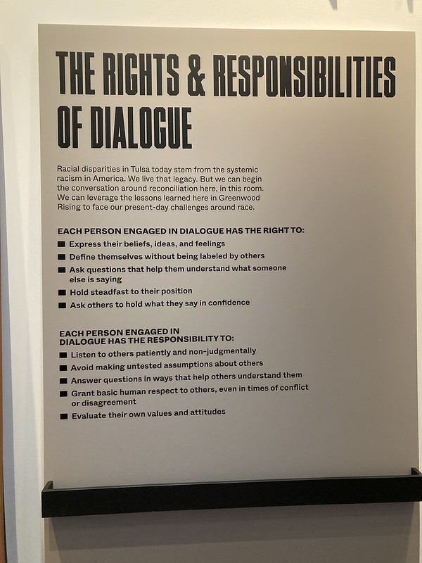
The museum has a lot to about the massacre but the emphasis is on the Greenwood community. It also has a lot about the forces of repression against people of color that has been occurring from the early days of Oklahoma right up to the present.

This isn’t the type of museum that has a lot of relics or art to look at. It’s more of a story telling museum using photographs, videos, and displays.

Greenwood was known as the “Black Wall Street” because of its prosperity. Cut off from the white part of town, Greenwood prospered and that was a problem for many in the white community.

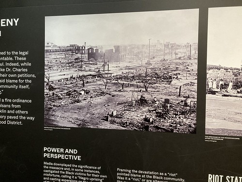
The massacre itself lasted less than 24 hours from May 31 to June 1, 1921. A white mob attacked the district and killed several hundred people and burned much of the area to the ground.

No white person was ever brought to justice. The blame was placed squarely on the residents. Although many had insurance nothing was paid under the provisions of riots exemptions.

Afterwards as the community struggled to rebuild, the City of Tulsa responded by requiring brick homes and other things meant to encourage the residents to sell out to white people.

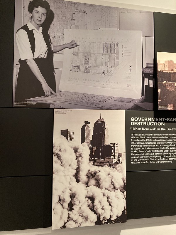
Eventually, the community rebuilt itself and then faced another destructive force. Urban Renewal led to the demolition of many homes and businesses and the construction of a freeway running right through the neighborhood. The white areas south of downtown got below grade freeways to minimze the impact the effect of the highway on the residents. The Greenwood area did not get the same consideration. To this day, there are vast areas just west of Greenwood that are still barren.

The community is resilient and is thriving.

The museum is about a lot more than the massacre.

There is still a fight going on. The Oklahoma legislature has passed laws making it hader to register and vote, aimed squarely at minority voters. The fragile white legislature have also passed laws that inhibit the teaching of the injustices of the past. It might be illegal to bring students to this museum.

I went through the museum, and I did not feel that white people are attacked or disparaged at all. The facility is telling a story in an even handed manner. They are telling the story of their community in a factual manner.

https://flic.kr/p/2nzAQ8Q

I highly recommend visiting Greenwood Rising. It is well done.

Note that they are closed for the month of August as they refresh the facility. They announced an interesting thing, you can get a preview of the museum for free on the smartphone app “Bloomberg Connects.” I downloaded it and it is a great app. You can tour lots of museums all across the world not just Greenwood Rising.

So, I recommend check Greenwood Rising out if you happen to be in the Tulsa area. Check the link for hours and other info.

I am posting at My Corner of the World. Come check it out.

Skywatch Friday – Harvey Young Airport

DSCF0085

I was out geocaching in east Tulsa the other day when I noticed a sign for Harvey Young Airport. The name sounded vaguely familiar so I drove down the road until it dead ended into the airport which had no gate or fence but a big No Trespassing sign. I always respect those and so stopped and took a couple of photos. There was not a whole lot to take photos.

DSCF0083-Edit

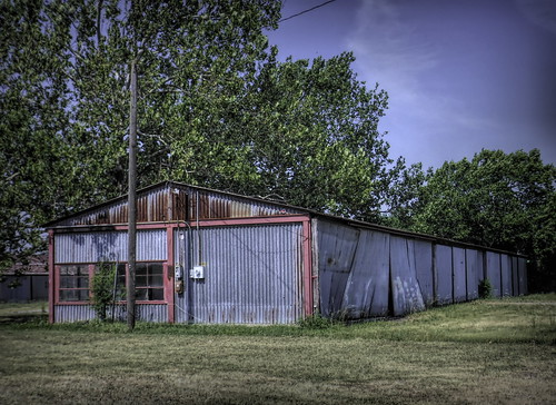
There was this old hangar. I posted this on Forgotten Oklahoma facebook group and somebody responded that it once housed an aircraft mechanic’s facility. The glassed in part was the office and the rest of it was where the work took place.

The airport was started by a guy named Harvey Young who landed in a pasture back in 1940 and ended up buying the land. It became a base for training military pilots during World War II and then reverted back to General Aviation afterward. Somebody bought the airport and announced big plans in 2017 to demolish the buildings and build new and cater to vintage airplanes. It doesn’t look like much has happened since then. The developer still has his web site up.

DSCF0084-Edit

This was the only aircraft I saw. A Beechcraft Bonanza. They have been in production since right after World War II. The V tail is its distinctive feature although there are Bonanza’s out there with the conventional tale. I found out that the Bonanza is also known as the Doctor Killer because it is a very expensive, high performance aircraft, and lots of professionals like doctors buy them but don’t have the necessary skills to fly it. Someone who is a pilot and has flown it told me that the V tail model in particular is very hard to control if you get into a spin.

A brand new Bonanza will cost you about one million dollars.

I am linking with Skywatch Friday.

Our World – New Route 66 Monument in Tulsa

DSCN7551

a bonus shadow selfie

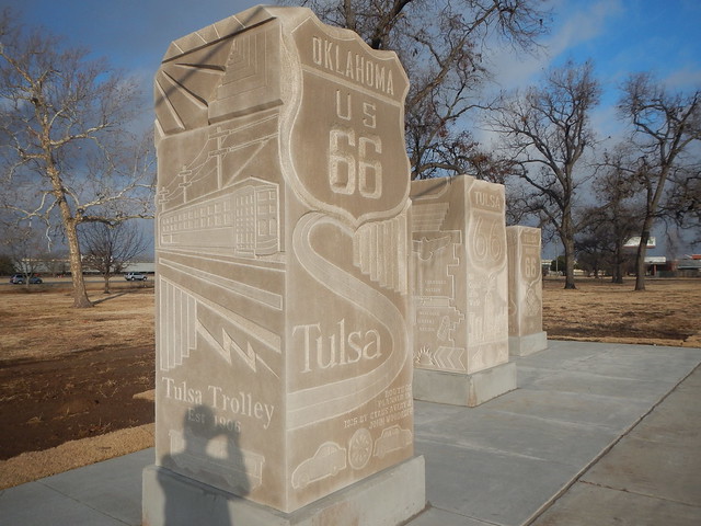
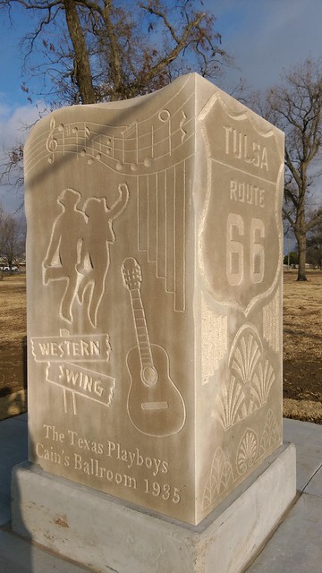
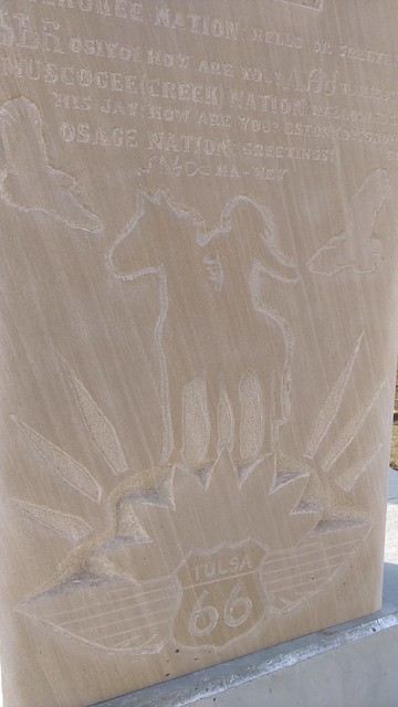
Tulsa’s Howard Park right on Route 66 in the city’s gritty industrial west side has a brand spanking new monument consisting of three big sculpted pillars of Indiana Limestone by Utah artist Patrick Sullivan.

IMAG1735

The pillars depict Tulsa sights like Cain’s Ballroom, art deco architecture, the energy, aviation, and railroad industries and Native American heritage.

IMAG1736

I love stuff like this. This monument is here to stay. An F5 tornado may topple them but they are not going anywhere.

An article from Route 66 News with video and a lot of the backstory on the monument and the artist who created it.

Howard Park’s Facebook site

I’m linking with Our World Tuesday


Skywatch Friday – Downtown Skies

Tulsa Skywatch

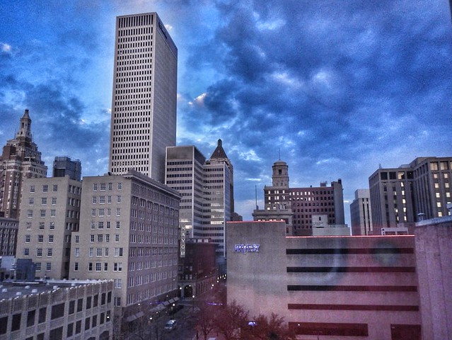
This is a view of downtown Tulsa. My favorite part of it is the reflection of my Nikon Coolpix AW110 against the building to the right. Used to be I’d worry about it and now, I’m like hey that is the way it is. There is lots of other things wrong with this picture but what is right about it is the tall building against the funky sky and the reflections of the western sun in the windows.

I also love it for the tower of the building to the far left, the 320 south Boston Building. Legend has it that the tower was designed to dock dirigible airships back in the 1920’s or so. I love that legend even though there are skeptics who say otherwise.  I say pooh on the skeptics,

What about you, do you have notions that the skeptics don’t like?

I’m linking with Skywatch Friday


Abandoned Buildings – The Catron Building

Catron Building - West of Downtown

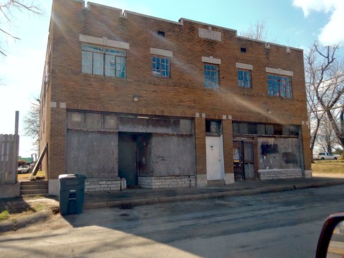
On a lunchtime geocaching expedition to a not great area of Tulsa just to the west of downtown Tulsa on West Admiral I found this gem of a building. It looks abandoned but there is a shiny mail slot in the door to the right and a city garbage container to the left. This looks like it used to be stores below and apartments or offices above. I”m trying to figure out what it used to be.  I love mysteries like this.

Digital Art Meme – 1931 Spartan Monoplane

Spartan C 2 60 - Topaz Glow - Squiggly Lines I 47 pct

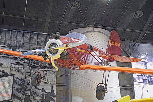
A Spartan Aviation C-2-60 Monoplane. A two seater with a three cylinder 60 horsepower engine built by Tulsa’s Spartan Aviation in 1930. Spartan was trying to deal with the reduction in market by building a cheaper lighter plane but only sixteen were ever built. I think it is sleek and beautiful. This one is on display at the Tulsa Air and Space Museum. Spartan is still in business as an aviation school.

I used Topaz Lab’s Glow software with the “Squiggly Lines” backed off about 50 percent. I like how the background colors faded to monochrome bringing the aircraft out of a very busy background.

Linking with Digital Art Meme

Tulsa’s Reservoir Hill Airport Arrow

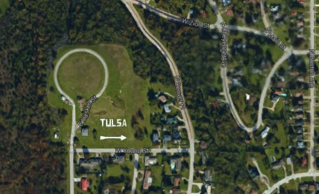
I was on Google Earth the other day trying to figure out how to get somewhere when something caught my eye. It was a a huge tag looking straight up into the sky with the words “Tulsa” and above it a similarly gigantic arrow pointing west. Below is a screenshot from Google Earth.

Tulsa Arrow

I looked at it and zoomed in and out and it looked a little photoshopped to me. You know, just too perfect and too white to be the real thing. By the way that loop road to the upper left of the TULSA sign surrounds a buried water reservoir still in use today. That is why the area is called reservoir hill. That and it is a hill.

Untitled

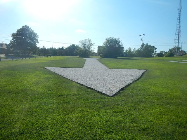
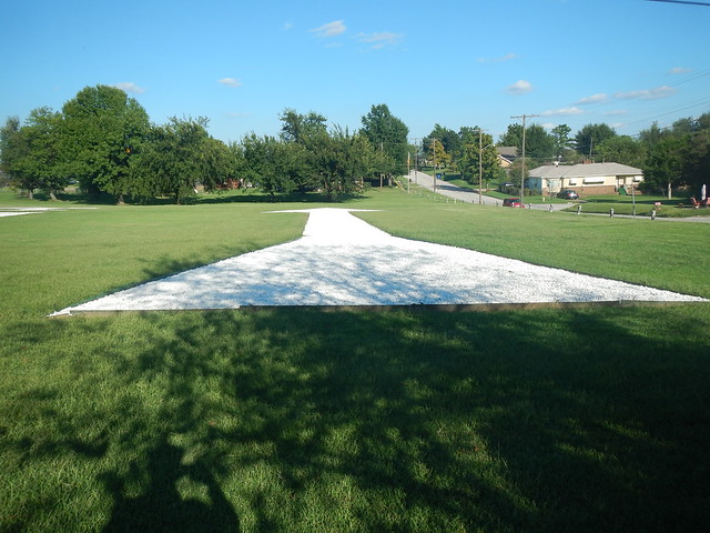
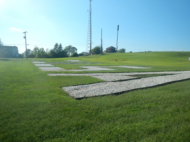
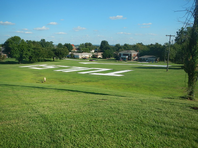
So after work naturally I had to run up there and see what’s what. Actually with my bum knee I drove up there and sure enough there is a huge arrow and TULSA sign made out of crushed rock.

DSCN4545

It turns out that this is a recreation of another arrow installed right on top of the reservoir back in 1927. It was part of a promotion celebrating a Charles Lindbergh transcontinental flight at that time. It pointed a little to the southeast of the where the present arrow points to which is the Tulsa International Airport. You can see a photo of the old arrow here.

Untitled

The new arrow was installed a few years ago with some bond money devoted to neighborhood projects. You can read about that here.

DSCN4538

It was kind of hard to get an elevated view of the sign and arrow even when I walked up the hill.

I think the whole thing is kind of cool. It is a bridge back to the 1920’s boomtown era and Charles Lindbergh, the oil tycoons that ruled Tulsa then and whose influence is still around today. I had never heard of this arrow before and I pride myself on knowing all sorts of little things about Tulsa.

Do you know any interesting tid bits about where you live that nobody else does?